Enhancing the Google imagery using a wavelet filter
Publication
Metrics
Paper Preview
Abstract
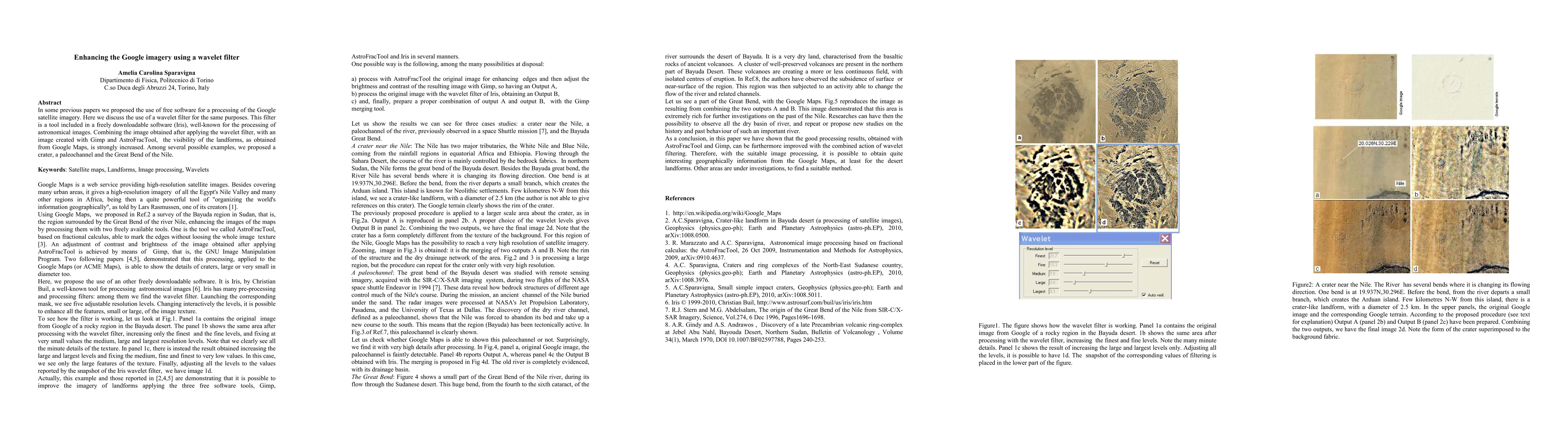
In some previous papers we proposed the use of free software for a processing of the Google satellite imagery. Here we discuss the use of a wavelet filter for the same purposes. This filter is a tool included in a freely downloadable software (Iris), well-known for the processing of astronomical images. Combining the image obtained after applying the wavelet filter, with an image created with Gimp and AstroFracTool, the visibility of the landforms, as obtained from Google Maps, is strongly increased. Among several possible examples, we proposed a crater, a paleochannel and the Great Bend of the Nile.
AI Key Findings
Get AI-generated insights about this paper's methodology, results, significance, and more — seven facets brought into focus.
Impact
Paper Details
PDF Preview
Key Terms
Citation Network
Current paper (gray), citations (green), references (blue)
Display is limited for performance on very large graphs.
Discussion 0