01
MethodologyHow they did it
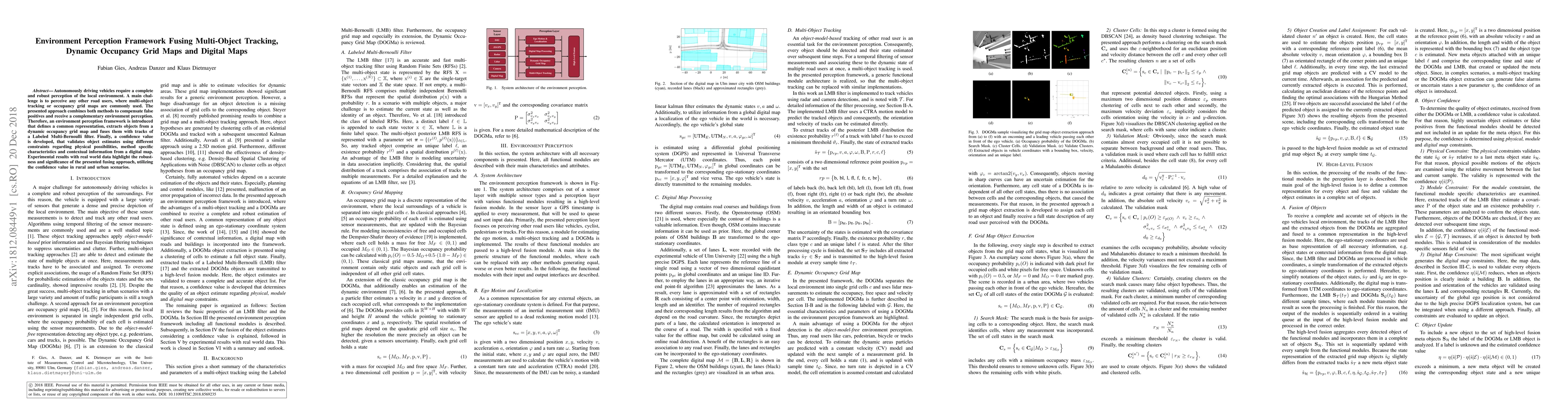
The research introduces an environment perception framework that combines multi-object tracking using a Labeled Multi-Bernoulli filter (LMB) with dynamic occupancy grid maps (DOGMa) and digital maps. It aims to provide a robust and complete perception of the local environment for autonomous vehicles by fusing these methods and incorporating a confidence value for object validation.
Discussion 0