Evacuation Planning on Time-Expanded Networks with Integrated Wildfire Information
Publication
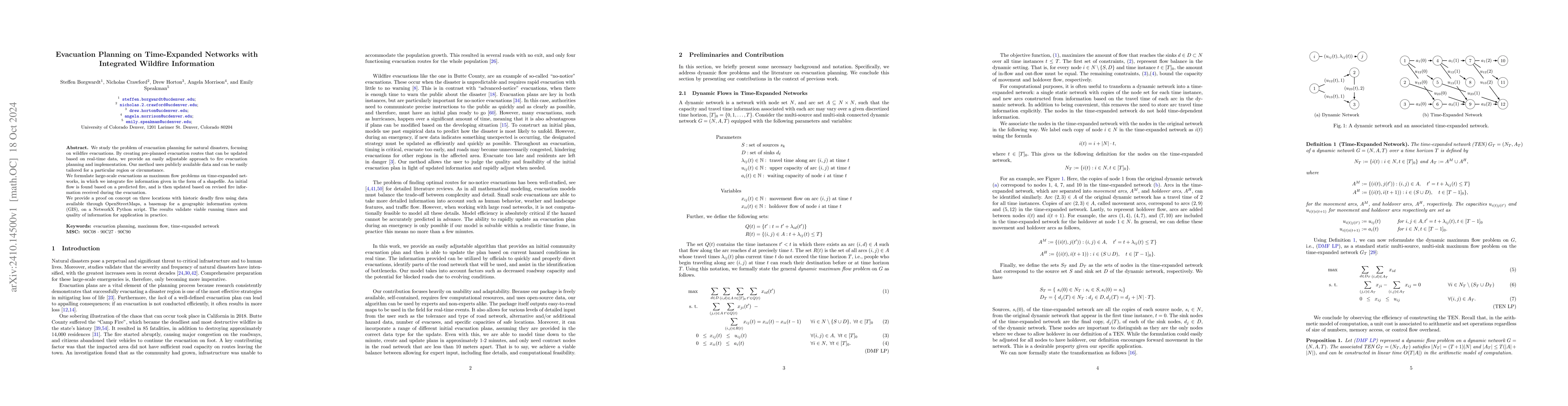
Metrics
AI Quick Summary
This paper proposes a dynamic evacuation planning method for wildfires using time-expanded network maximum flow problems, integrating real-time fire data for adaptable routes. The approach is validated on three historic wildfire locations using OpenStreetMaps data, demonstrating practical viability.
Paper Preview
Abstract
We study the problem of evacuation planning for natural disasters, focusing on wildfire evacuations. By creating pre-planned evacuation routes that can be updated based on real-time data, we provide an easily adjustable approach to fire evacuation planning and implementation. Our method uses publicly available data and can be easily tailored for a particular region or circumstance. We formulate large-scale evacuations as maximum flow problems on time-expanded networks, in which we integrate fire information given in the form of a shapefile. An initial flow is found based on a predicted fire, and is then updated based on revised fire information received during the evacuation. We provide a proof on concept on three locations with historic deadly fires using data available through OpenStreetMaps, a basemap for a geographic information system (GIS), on a NetworkX Python script. The results validate viable running times and quality of information for application in practice.
AI Key Findings
Get AI-generated insights about this paper's methodology, results, significance, and more — seven facets brought into focus.
Impact
Authors
PDF Preview
Citation Network
Current paper (gray), citations (green), references (blue)
Display is limited for performance on very large graphs.
Discussion 0