Publication
Metrics
Paper Preview
Abstract
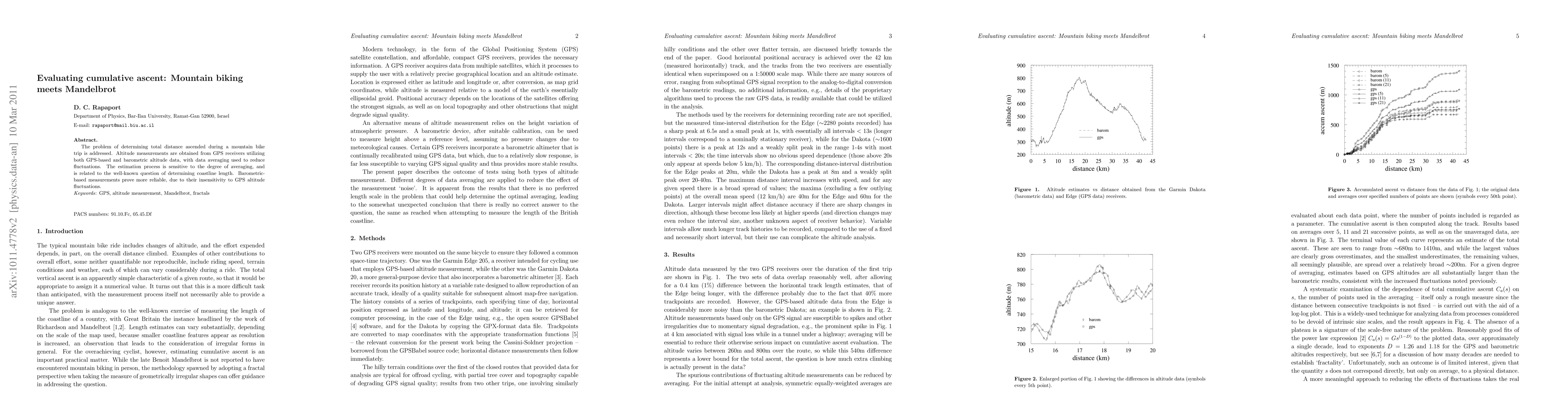
The problem of determining total distance ascended during a mountain bike trip is addressed. Altitude measurements are obtained from GPS receivers utilizing both GPS-based and barometric altitude data, with data averaging used to reduce fluctuations. The estimation process is sensitive to the degree of averaging, and is related to the well-known question of determining coastline length. Barometric-based measurements prove more reliable, due to their insensitivity to GPS altitude fluctuations.
AI Key Findings
Get AI-generated insights about this paper's methodology, results, significance, and more — seven facets brought into focus.
Impact
Paper Details
PDF Preview
Key Terms
Citation Network
Current paper (gray), citations (green), references (blue)
Display is limited for performance on very large graphs.
Discussion 0