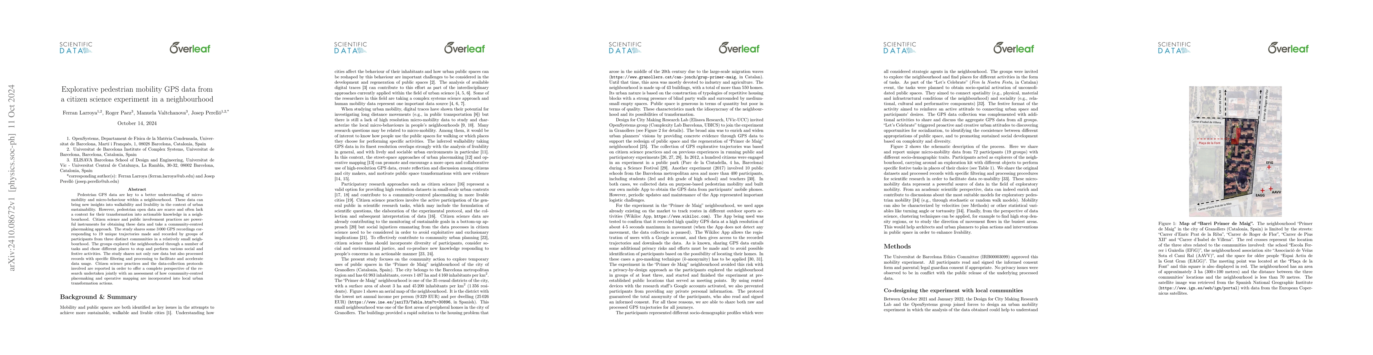
Explorative pedestrian mobility GPS data from a citizen science experiment in a neighbourhood
Publication
Metrics
AI Quick Summary
This study uses citizen science to gather pedestrian GPS data from three communities to understand micro-mobility and urban sustainability. It provides 3000 GPS recordings from 19 unique trajectories, emphasizing community-centred placemaking and the potential of open data for urban transformation.
Paper Preview
Abstract
Pedestrian GPS data are key to a better understanding of micro-mobility and micro-behaviour within a neighbourhood. These data can bring new insights into walkability and livability in the context of urban sustainability. However, pedestrian open data are scarce and often lack a context for their transformation into actionable knowledge in a neighbourhood. Citizen science and public involvement practices are powerful instruments for obtaining these data and take a community-centred placemaking approach. The study shares some 3000 GPS recordings corresponding to 19 unique trajectories made and recorded by groups of participants from three distinct communities in a relatively small neighbourhood. The groups explored the neighbourhood through a number of tasks and chose different places to stop and perform various social and festive activities. The study shares not only raw data but also processed records with specific filtering and processing to facilitate and accelerate data usage. Citizen science practices and the data-collection protocols involved are reported in order to offer a complete perspective of the research undertaken jointly with an assessment of how community-centred placemaking and operative mapping are incorporated into local urban transformation actions.
AI Key Findings
Get AI-generated insights about this paper's methodology, results, significance, and more — seven facets brought into focus.
Impact
Authors
PDF Preview
Citation Network
Current paper (gray), citations (green), references (blue)
Display is limited for performance on very large graphs.
Discussion 0