Publication
Metrics
AI Quick Summary
This paper presents a novel method to extract the fundamental diagram of traffic networks using aerial footage from drones. The approach involves vehicle detection, vehicle tracking, and traffic state estimation, demonstrating its effectiveness in real-world applications for congestion monitoring.
Paper Preview
Abstract
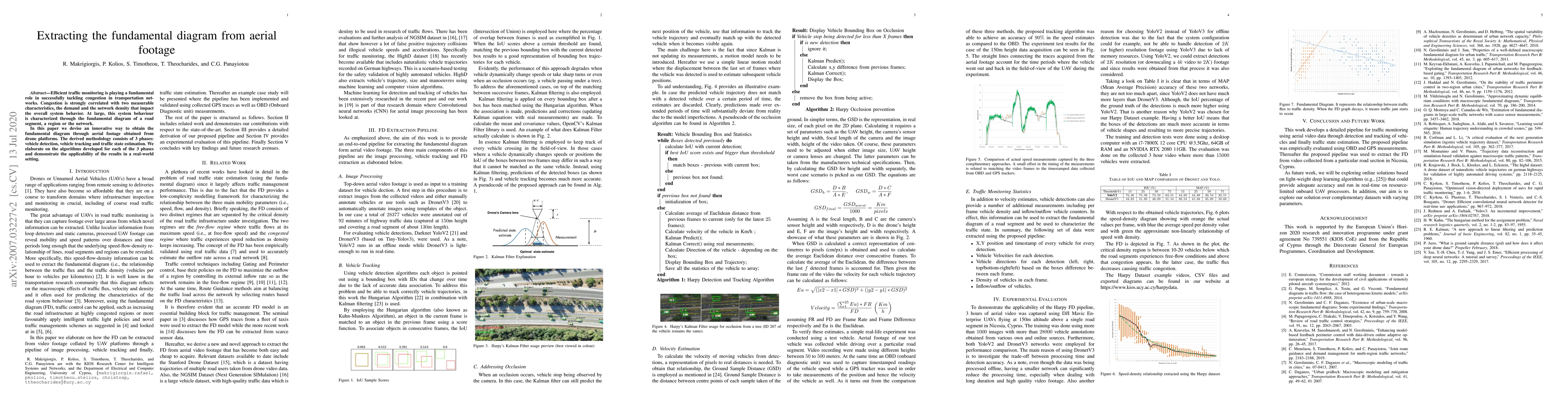
Efficient traffic monitoring is playing a fundamental role in successfully tackling congestion in transportation networks. Congestion is strongly correlated with two measurable characteristics, the demand and the network density that impact the overall system behavior. At large, this system behavior is characterized through the fundamental diagram of a road segment, a region or the network. In this paper we devise an innovative way to obtain the fundamental diagram through aerial footage obtained from drone platforms. The derived methodology consists of 3 phases: vehicle detection, vehicle tracking and traffic state estimation. We elaborate on the algorithms developed for each of the 3 phases and demonstrate the applicability of the results in a real-world setting.
AI Key Findings
Get AI-generated insights about this paper's methodology, results, significance, and more — seven facets brought into focus.
Impact
Paper Details
Authors
PDF Preview
Key Terms
Citation Network
Current paper (gray), citations (green), references (blue)
Display is limited for performance on very large graphs.
Discussion 0