Authors
Summary
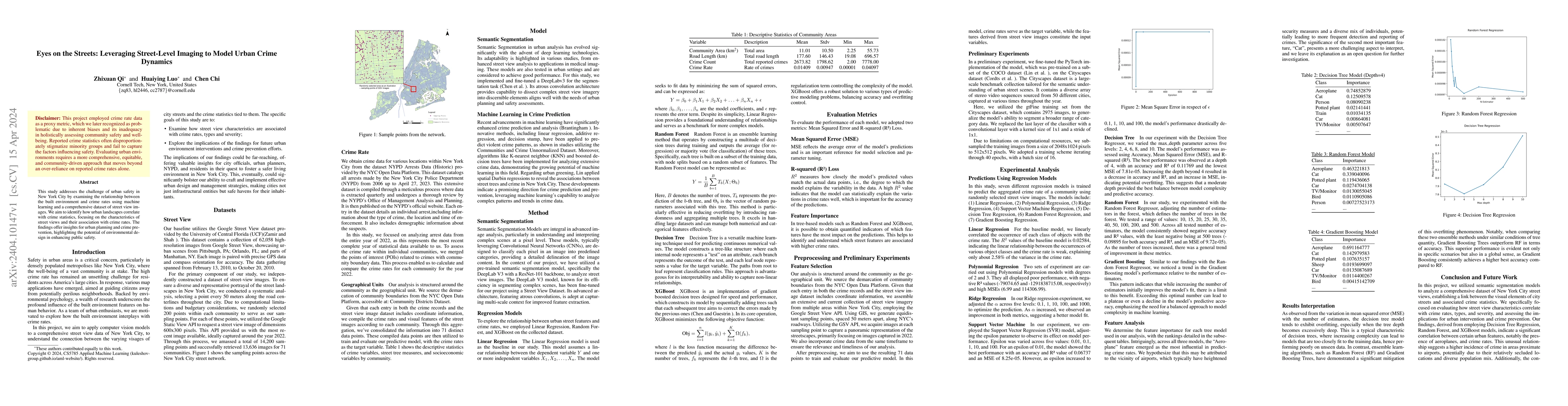
This study addresses the challenge of urban safety in New York City by examining the relationship between the built environment and crime rates using machine learning and a comprehensive dataset of street view images. We aim to identify how urban landscapes correlate with crime statistics, focusing on the characteristics of street views and their association with crime rates. The findings offer insights for urban planning and crime prevention, highlighting the potential of environmental design in enhancing public safety.
AI Key Findings
Get AI-generated insights about this paper's methodology, results, and significance.
Paper Details
PDF Preview
Key Terms
Citation Network
Current paper (gray), citations (green), references (blue)
Display is limited for performance on very large graphs.
Similar Papers
Found 4 papersDiversity beyond density: experienced social mixing of urban streets
Fan Zhang, Esteban Moro, Tianyu Su et al.
Bayesian Network Regularized Regression for Modeling Urban Crime Occurrences
Elizabeth Upton, Luis Carvalho
No citations found for this paper.
Comments (0)