Publication

Published: Feb 13, 2025
Categories: cs.CV

Metrics

Source: ArXiv

Quick Actions

View PDF

AI Quick Summary

FLARES presents a redesigned workflow for LiDAR multi-range semantic segmentation, demonstrating improved efficiency and accuracy by lowering the resolution to mitigate information loss and computational demands, outperforming traditional high-resolution approaches in autonomous driving applications. The proposed methods significantly enhance performance on public datasets, advancing LiDAR-based perception.

Quick Answers

What is "FLARES: Fast and Accurate LiDAR Multi-Range Semantic Segmentation" about?

FLARES presents a redesigned workflow for LiDAR multi-range semantic segmentation, demonstrating improved efficiency and accuracy by lowering the resolution to mitigate information loss and computational demands, outperforming traditional high-resolution approaches in autonomous driving applications. The proposed methods significantly enhance performance on public datasets, advancing LiDAR-based perception.

What methodology did the authors use?

The paper introduces FLARES, a comprehensive redesign of the workflow for range-view-based LiDAR semantic segmentation. It focuses on data representation, augmentation, and post-processing methods to enhance performance and efficiency. More in Methodology →

What are the key results?

FLARES significantly improves the performance of various network architectures over their baselines on SemanticKITTI and nuScenes datasets. — Decreasing the azimuth resolution in range-view projection proves more advantageous in efficiency and accuracy compared to higher resolutions. More in Key Results →

Why is this work significant?

This research is important as it paves the way for more effective LiDAR-based perception in autonomous systems by improving the efficiency and accuracy of 3D scene understanding from LiDAR data. More in Significance →

What are the main limitations?

The method may face challenges with class imbalance in datasets, as evidenced by decreased performance on the motorcyclist class in SemanticKITTI. — The approach's effectiveness might vary depending on the specific characteristics of LiDAR datasets, such as point cloud density and class distribution. More in Limitations →

Paper Preview

Abstract

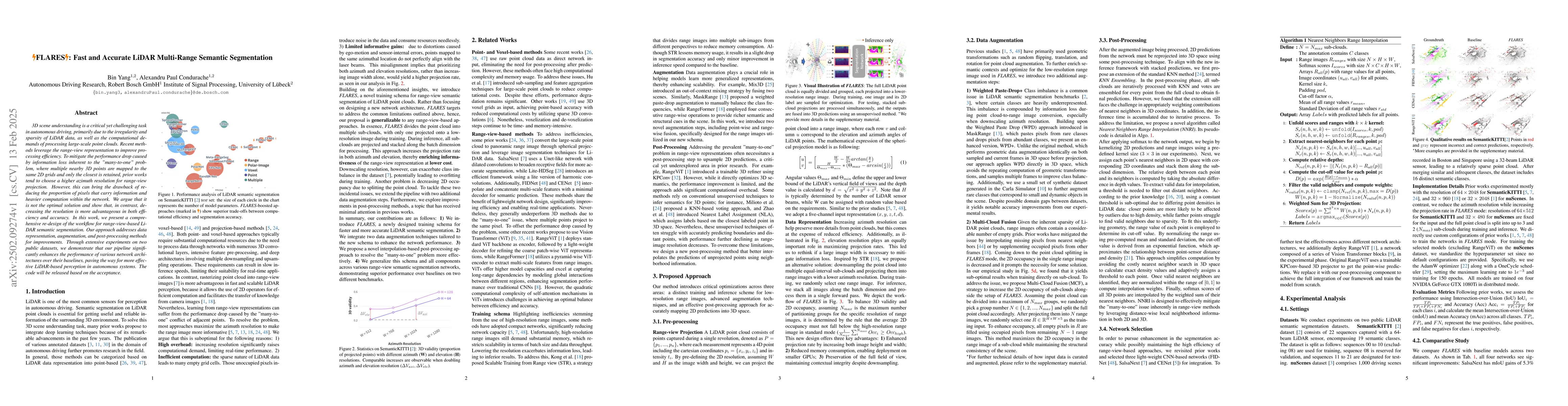
3D scene understanding is a critical yet challenging task in autonomous driving, primarily due to the irregularity and sparsity of LiDAR data, as well as the computational demands of processing large-scale point clouds. Recent methods leverage the range-view representation to improve processing efficiency. To mitigate the performance drop caused by information loss inherent to the "many-to-one" problem, where multiple nearby 3D points are mapped to the same 2D grids and only the closest is retained, prior works tend to choose a higher azimuth resolution for range-view projection. However, this can bring the drawback of reducing the proportion of pixels that carry information and heavier computation within the network. We argue that it is not the optimal solution and show that, in contrast, decreasing the resolution is more advantageous in both efficiency and accuracy. In this work, we present a comprehensive re-design of the workflow for range-view-based LiDAR semantic segmentation. Our approach addresses data representation, augmentation, and post-processing methods for improvements. Through extensive experiments on two public datasets, we demonstrate that our pipeline significantly enhances the performance of various network architectures over their baselines, paving the way for more effective LiDAR-based perception in autonomous systems.
AI Key Findings

Generated Jun 11, 2025

Methodology — What approach did the authors take?

The paper introduces FLARES, a comprehensive redesign of the workflow for range-view-based LiDAR semantic segmentation. It focuses on data representation, augmentation, and post-processing methods to enhance performance and efficiency.

Key Results — What are the main findings?

  • FLARES significantly improves the performance of various network architectures over their baselines on SemanticKITTI and nuScenes datasets.
  • Decreasing the azimuth resolution in range-view projection proves more advantageous in efficiency and accuracy compared to higher resolutions.
  • The proposed data augmentation techniques, Weighted Paste-Drop+ (WPD+) and Multi-Cloud Fusion (MCF), contribute to better class balancing and occupancy in range images.
  • A novel post-processing algorithm, Nearest Neighbors Range Interpolation (NNRI), effectively addresses the 'many-to-one' issue in range-view methods by leveraging distance-wise local neighborhood information in both 2D and 3D.

Significance — Why does this research matter?

This research is important as it paves the way for more effective LiDAR-based perception in autonomous systems by improving the efficiency and accuracy of 3D scene understanding from LiDAR data.

Technical Contribution — What is the technical contribution?

The main technical contribution of this work is the FLARES framework, which includes optimized data augmentation techniques (WPD+ and MCF) and a novel post-processing method (NNRI) for LiDAR semantic segmentation.

Novelty — What is new about this work?

The paper's novelty lies in its comprehensive redesign of the range-view-based LiDAR semantic segmentation workflow, emphasizing decreased azimuth resolution, enhanced data augmentation, and an innovative post-processing algorithm to improve performance and efficiency.

Limitations — What are the limitations of this study?

  • The method may face challenges with class imbalance in datasets, as evidenced by decreased performance on the motorcyclist class in SemanticKITTI.
  • The approach's effectiveness might vary depending on the specific characteristics of LiDAR datasets, such as point cloud density and class distribution.

Future Work — What did the authors propose for future work?

  • Exploring 3D reconstruction techniques to generate real-world-like pseudo LiDAR point clouds for augmentation to address class imbalance issues.
  • Investigating the integration of FLARES with other sensor modalities for more robust perception in autonomous driving.

Paper Details

Paper ID: 2502.09274
Categories:
cs.CV

How to Cite This Paper

BibTeX
@article{condurache2025flares,
  title         = {FLARES: Fast and Accurate LiDAR Multi-Range Semantic Segmentation},
  author        = {Condurache, Alexandru Paul and Yang, Bin},
  year          = {2025},
  eprint        = {2502.09274},
  archivePrefix = {arXiv},
  primaryClass  = {cs.CV},
}
APA 7
Condurache, A., & Yang, B. (2025). FLARES: Fast and Accurate LiDAR Multi-Range Semantic Segmentation. arXiv. https://arxiv.org/abs/2502.09274
MLA 9
Condurache, Alexandru Paul, and Bin Yang. "FLARES: Fast and Accurate LiDAR Multi-Range Semantic Segmentation." arXiv, 2025, arxiv.org/abs/2502.09274.

No citations found for this paper.

Comments (0)

This website uses cookies to ensure you get the best experience. Learn more