Summary
Over the past few decades, floods have become one of the costliest natural hazards and losses have sharply escalated. Floods are an increasing problem in urban areas due to increased residential settlement along the coastline and climate change is a contributing factor to this increased frequency. In order to analyze flood risk, a model is proposed to identify the factors associated with increased flooding at a local scale. The study area includes National Harbor, MD, and the surrounding area of Fort Washington. The objective is to assess flood risk due to an increase in sea level rise for the study area of interest. The study demonstrated that coastal flood risk increased with sea level rise even though the predicted level of impact is fairly insignificant for the study area. The level of impact from increased flooding is highly dependent on the location of the properties and other topographic information.
AI Key Findings
Get AI-generated insights about this paper's methodology, results, and significance.
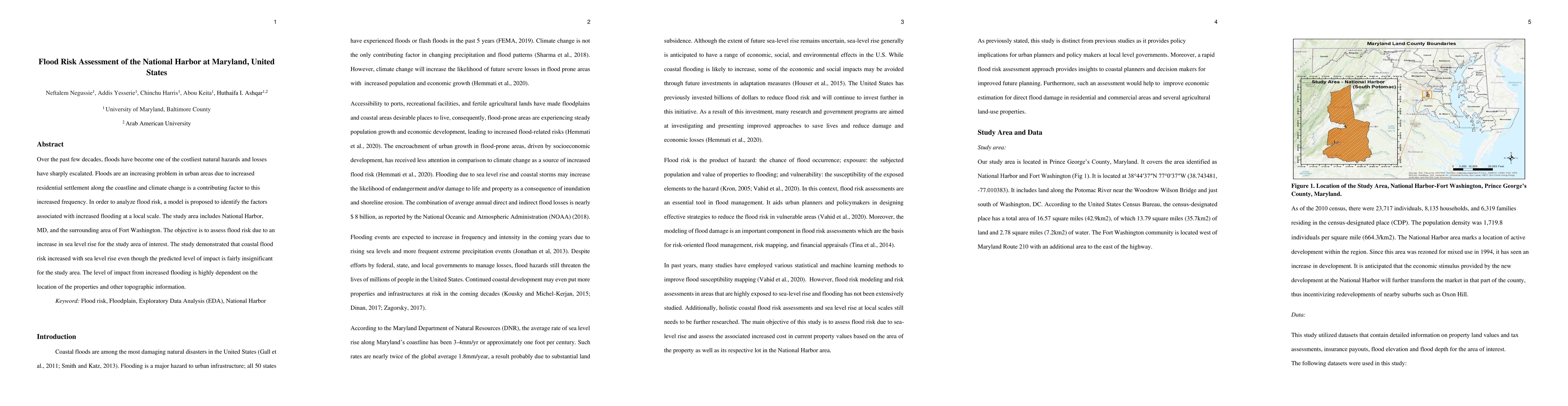
Paper Details
PDF Preview
Citation Network
Current paper (gray), citations (green), references (blue)
Display is limited for performance on very large graphs.
Similar Papers
Found 4 papersA holistic methodology for evaluating flood vulnerability, generating flood risk map and conducting detailed flood inundation assessment.
Devi, Kamalini, Reddy, Chundi Chenna, Rahul, Kandakatla et al.
Rethinking Urban Flood Risk Assessment By Adapting Health Domain Perspective
Ali Mostafavi, Kai Yin, Zhewei Liu
A Review on Flood Risk Conceptual Frameworks and Development of Hierarchical Structures for Assessment Criteria
Mohammad Fereshtehpour, Nazgol Tabasi, Bardia Roghani
No citations found for this paper.
Comments (0)