Publication
Metrics
AI Quick Summary
This paper develops a flood risk map for São Paulo, Brazil, using hydrological and mobility data. It estimates flood susceptibility via the Height Above the Nearest Drainage algorithm and assesses potential impacts through exposure and vulnerability, classifying them into three levels. The susceptibility component, influenced by watercourses, significantly impacts the Very High classification.
Paper Preview
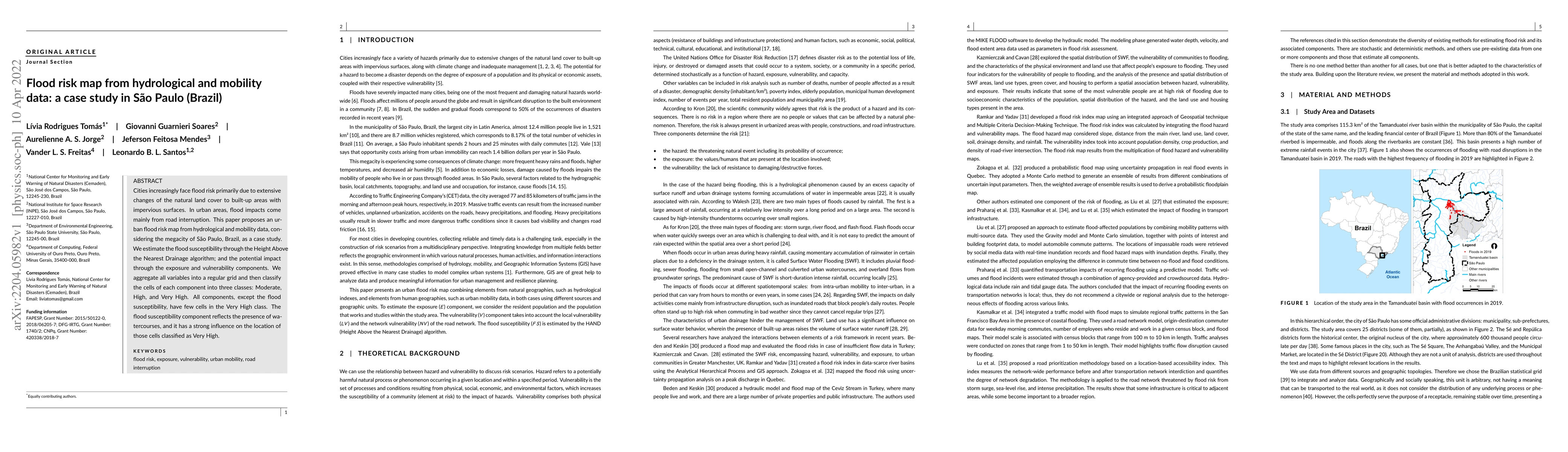
Abstract
Cities increasingly face flood risk primarily due to extensive changes of the natural land cover to built-up areas with impervious surfaces. In urban areas, flood impacts come mainly from road interruption. This paper proposes an urban flood risk map from hydrological and mobility data, considering the megacity of S\~ao Paulo, Brazil, as a case study. We estimate the flood susceptibility through the Height Above the Nearest Drainage algorithm; and the potential impact through the exposure and vulnerability components. We aggregate all variables into a regular grid and then classify the cells of each component into three classes: Moderate, High, and Very High. All components, except the flood susceptibility, have few cells in the Very High class. The flood susceptibility component reflects the presence of watercourses, and it has a strong influence on the location of those cells classified as Very High.
AI Key Findings
Get AI-generated insights about this paper's methodology, results, significance, and more — seven facets brought into focus.
Impact
Paper Details
Authors
PDF Preview
Key Terms
Citation Network
Current paper (gray), citations (green), references (blue)
Display is limited for performance on very large graphs.
Discussion 0