Summary

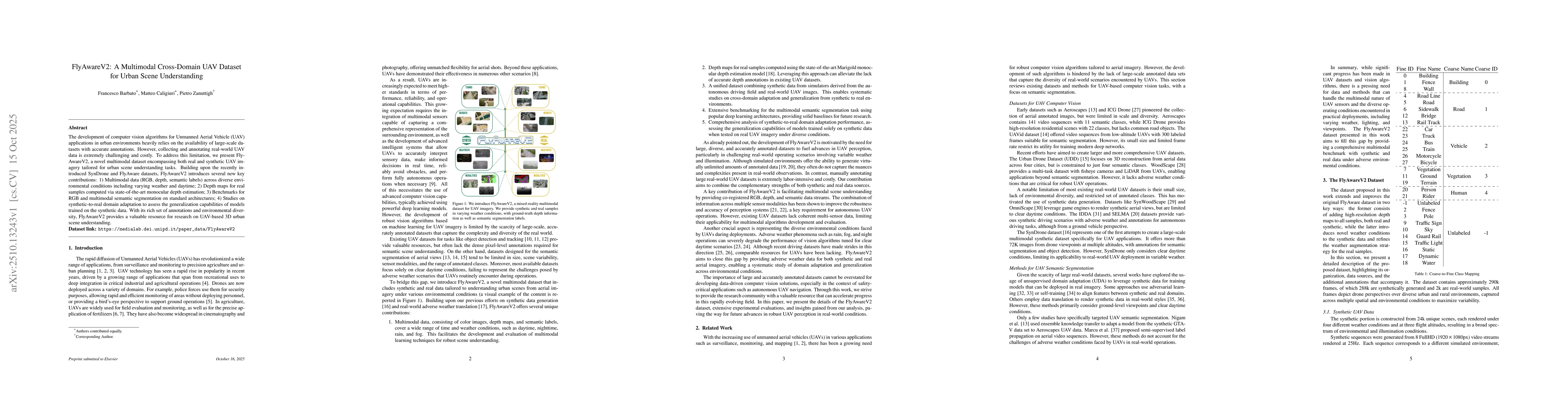
The development of computer vision algorithms for Unmanned Aerial Vehicle (UAV) applications in urban environments heavily relies on the availability of large-scale datasets with accurate annotations. However, collecting and annotating real-world UAV data is extremely challenging and costly. To address this limitation, we present FlyAwareV2, a novel multimodal dataset encompassing both real and synthetic UAV imagery tailored for urban scene understanding tasks. Building upon the recently introduced SynDrone and FlyAware datasets, FlyAwareV2 introduces several new key contributions: 1) Multimodal data (RGB, depth, semantic labels) across diverse environmental conditions including varying weather and daytime; 2) Depth maps for real samples computed via state-of-the-art monocular depth estimation; 3) Benchmarks for RGB and multimodal semantic segmentation on standard architectures; 4) Studies on synthetic-to-real domain adaptation to assess the generalization capabilities of models trained on the synthetic data. With its rich set of annotations and environmental diversity, FlyAwareV2 provides a valuable resource for research on UAV-based 3D urban scene understanding.

AI Key Findings

Generated Oct 30, 2025

Methodology

The research introduces FlyAwareV2, a large-scale dataset combining synthetic and real-world multimodal data under varying weather conditions. It evaluates segmentation models' performance across different environments using extensive synthetic data for training and real-world imagery for testing.

Key Results

  • Training with synthetic data achieves effective performance on real-world imagery
  • Segmentation models show varying capabilities across different weather, time of day, and flying heights
  • Multimodal data exploitation improves segmentation performance

Significance

This work advances UAV computer vision by providing a comprehensive dataset and insights into domain adaptation challenges, enabling robust perception in adverse conditions for applications like agriculture and surveillance.

Technical Contribution

Development of FlyAwareV2 dataset with synthetic-real multimodal data and analysis of domain transfer capabilities across environmental factors

Novelty

Integration of extensive synthetic data with real-world imagery for domain adaptation research and the systematic analysis of environmental factors' impact on segmentation performance

Limitations

  • Real-world data collection limitations
  • Generalization to unseen environments may be constrained
  • Computational costs of multimodal processing

Future Work

  • Expanding dataset with additional vision tasks
  • Increasing real-world data diversity
  • Optimizing multimodal processing efficiency

Paper Details

PDF Preview

Download PDF

Comments (0)

This website uses cookies to ensure you get the best experience. Learn more