Focusing on Shadows for Predicting Heightmaps from Single Remotely Sensed RGB Images with Deep Learning
Publication
Metrics
AI Quick Summary
This paper proposes a Deep Learning model that leverages shadow information from single remotely sensed RGB images to predict heightmaps, achieving superior performance compared to traditional methods. The model, trained with aerial images and Lidar measurements, demonstrates effective heightmap estimation without significant computational overhead.
Paper Preview
Abstract
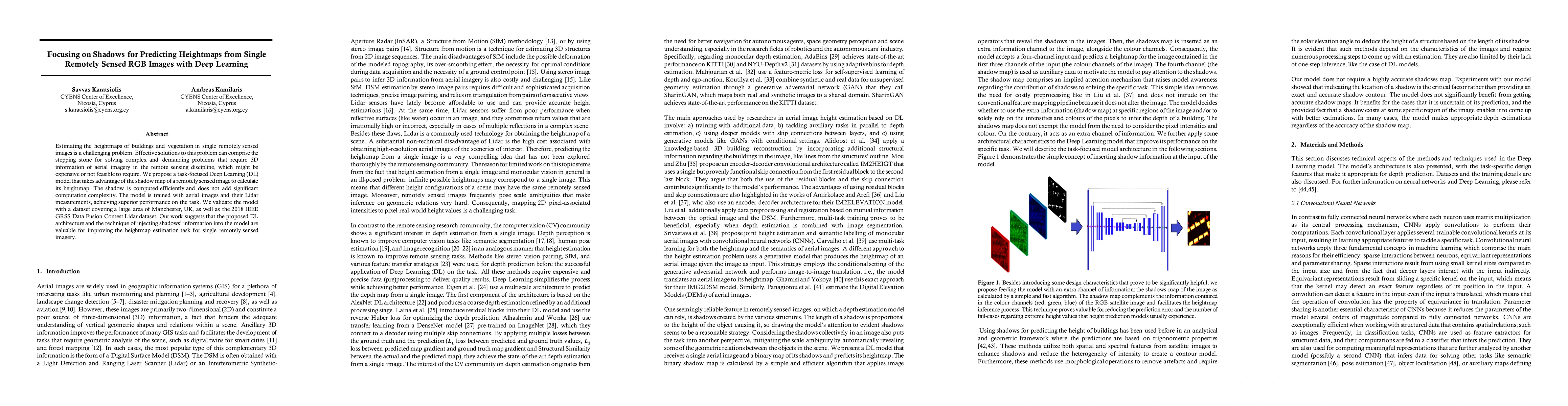
Estimating the heightmaps of buildings and vegetation in single remotely sensed images is a challenging problem. Effective solutions to this problem can comprise the stepping stone for solving complex and demanding problems that require 3D information of aerial imagery in the remote sensing discipline, which might be expensive or not feasible to require. We propose a task-focused Deep Learning (DL) model that takes advantage of the shadow map of a remotely sensed image to calculate its heightmap. The shadow is computed efficiently and does not add significant computation complexity. The model is trained with aerial images and their Lidar measurements, achieving superior performance on the task. We validate the model with a dataset covering a large area of Manchester, UK, as well as the 2018 IEEE GRSS Data Fusion Contest Lidar dataset. Our work suggests that the proposed DL architecture and the technique of injecting shadows information into the model are valuable for improving the heightmap estimation task for single remotely sensed imagery.
AI Key Findings
Get AI-generated insights about this paper's methodology, results, significance, and more — seven facets brought into focus.
Impact
Paper Details
Authors
PDF Preview
Key Terms
Citation Network
Current paper (gray), citations (green), references (blue)
Display is limited for performance on very large graphs.
Discussion 0