01
MethodologyHow they did it
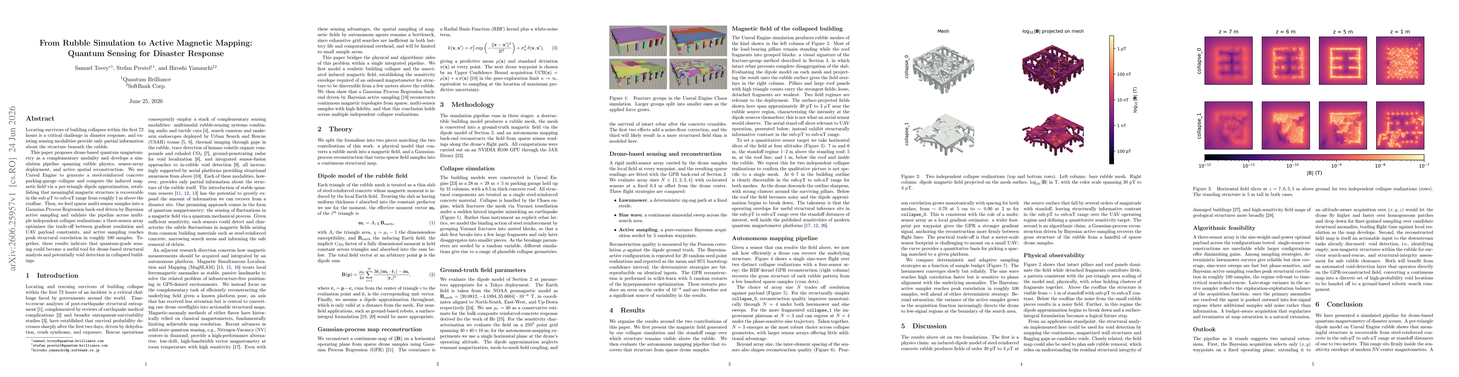
A three-stage simulation pipeline combines (1) a Rubble Collapse model in Unreal Engine that generates a 28m x 28m x 5m parking-garage rubble mesh with Voronoi-based fracture and a dipole-based magnetic field model, (2) a ground-truth magnetic field computation using a per-triangle dipole approximation, and (3) a Gaussian Process Regression back-end with an Upper Confidence Bound acquisition function to reconstruct a continuous magnetic field map from sparse drone-mounted sensor readings collected along flight paths. All computations are executed on an NVIDIA H100 GPU using the JAX library to enable fast, batched evaluation and active-sampling-driven optimization of sensor placements.
Discussion 0