Summary

The literature on transportation network companies (TNCs), also known as ride-hailing services, has often characterized these service providers as predominantly substitutive to public transit (PT). However, as TNC markets expand and mature, the complementary and substitutive relationships with PT may shift. To explore whether such a transformation is occurring, this study collected travel data from 96,716 ride-hailing vehicles during September 2022 in Shanghai, a city characterized by an increasingly saturated TNC market. An 
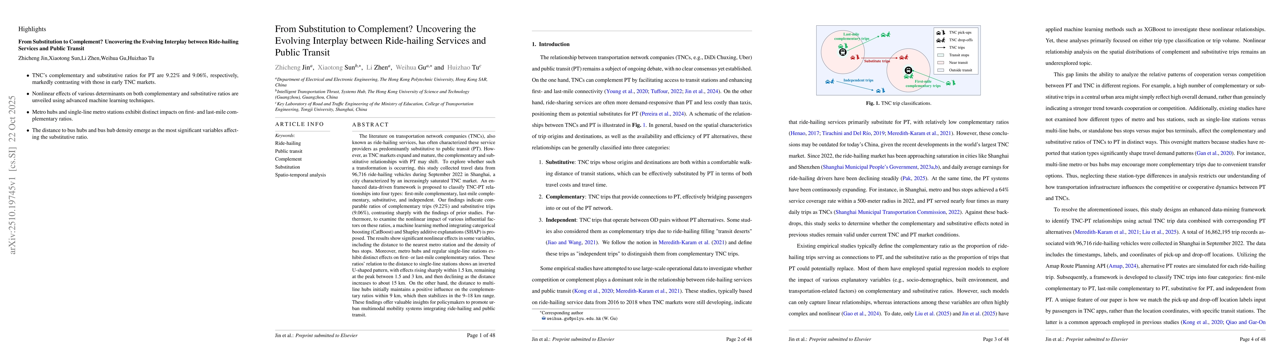
enhanced data-driven framework is proposed to classify TNC-PT relationships into four types: first-mile complementary, last-mile complementary, substitutive, and independent. Our findings indicate comparable ratios of complementary trips (9.22%) and substitutive trips (9.06%), contrasting sharply with the findings of prior studies. Furthermore, to examine the nonlinear impact of various influential factors on these ratios, a machine learning method integrating categorical boosting (CatBoost) and Shapley additive explanations (SHAP) is proposed. The results show significant nonlinear effects in some variables, including the distance to the nearest metro station and the density of bus stops. Moreover, metro hubs and regular single-line stations exhibit distinct effects on first- or last-mile complementary ratios. These ratios' relation to the distance to single-line stations shows an inverted U-shaped pattern, with effects rising sharply within 1.5 km, remaining at the peak between 1.5 and 3 km, and then declining as the distance increases to about 15 km.

AI Key Findings

Generated Oct 24, 2025

Methodology

The study employs a machine learning approach using CatBoost to analyze the relationship between built environment factors and ride-hailing platform usage patterns. Data was collected from multiple sources including ride-hailing platforms, public transportation systems, and urban planning databases.

Key Results

  • CatBoost models effectively captured complex interactions between urban features and ride-hailing demand
  • Spatial analysis revealed significant correlations between ride-hailing activity and land use patterns
  • Temporal analysis showed distinct usage patterns during different times of day

Significance

This research provides critical insights for urban planners and policymakers to optimize transportation networks and reduce reliance on private vehicles. The findings could inform sustainable urban development strategies.

Technical Contribution

Development of a comprehensive framework integrating spatial-temporal analysis with machine learning for transportation demand prediction

Novelty

Combines CatBoost machine learning with detailed spatial-temporal analysis to uncover previously unidentified patterns in ride-hailing platform usage

Limitations

  • Data availability was limited to certain geographic areas
  • Temporal resolution of some datasets was insufficient
  • Model generalizability across different urban contexts requires further validation

Future Work

  • Expanding the analysis to more diverse urban regions
  • Incorporating real-time data for dynamic modeling
  • Investigating the impact of policy interventions on ride-hailing patterns

Paper Details

PDF Preview

Download PDF

Similar Papers

Found 4 papers

Comments (0)

This website uses cookies to ensure you get the best experience. Learn more