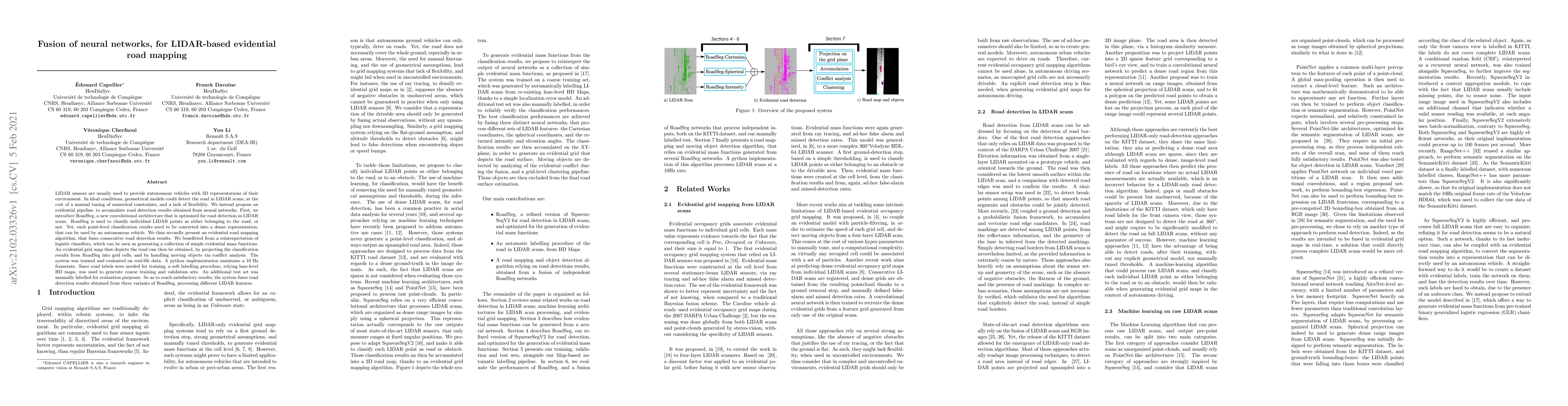
LIDAR sensors are usually used to provide autonomous vehicles with 3D
representations of their environment. In ideal conditions, geometrical models
could detect the road in LIDAR scans, at the cost of a manual tuning of
numerical constraints, and a lack of flexibility. We instead propose an
evidential pipeline, to accumulate road detection results obtained from neural
networks. First, we introduce RoadSeg, a new convolutional architecture that is
optimized for road detection in LIDAR scans. RoadSeg is used to classify
individual LIDAR points as either belonging to the road, or not. Yet, such
point-level classification results need to be converted into a dense
representation, that can be used by an autonomous vehicle. We thus secondly
present an evidential road mapping algorithm, that fuses consecutive road
detection results. We benefitted from a reinterpretation of logistic
classifiers, which can be seen as generating a collection of simple evidential
mass functions. An evidential grid map that depicts the road can then be
obtained, by projecting the classification results from RoadSeg into grid
cells, and by handling moving objects via conflict analysis. The system was
trained and evaluated on real-life data. A python implementation maintains a 10
Hz framerate. Since road labels were needed for training, a soft labelling
procedure, relying lane-level HD maps, was used to generate coarse training and
validation sets. An additional test set was manually labelled for evaluation
purposes. So as to reach satisfactory results, the system fuses road detection
results obtained from three variants of RoadSeg, processing different LIDAR
features.
Discussion 0