Publication
Metrics
AI Quick Summary
This paper explores Galileo Galilei's groundbreaking discovery of Jupiter's satellites, which provided a theoretical basis for determining longitude at sea, although it was impractical during his era. Today, satellite navigation systems, named after Galileo, have made his concept a reality in modern cartography.
Paper Preview
Abstract
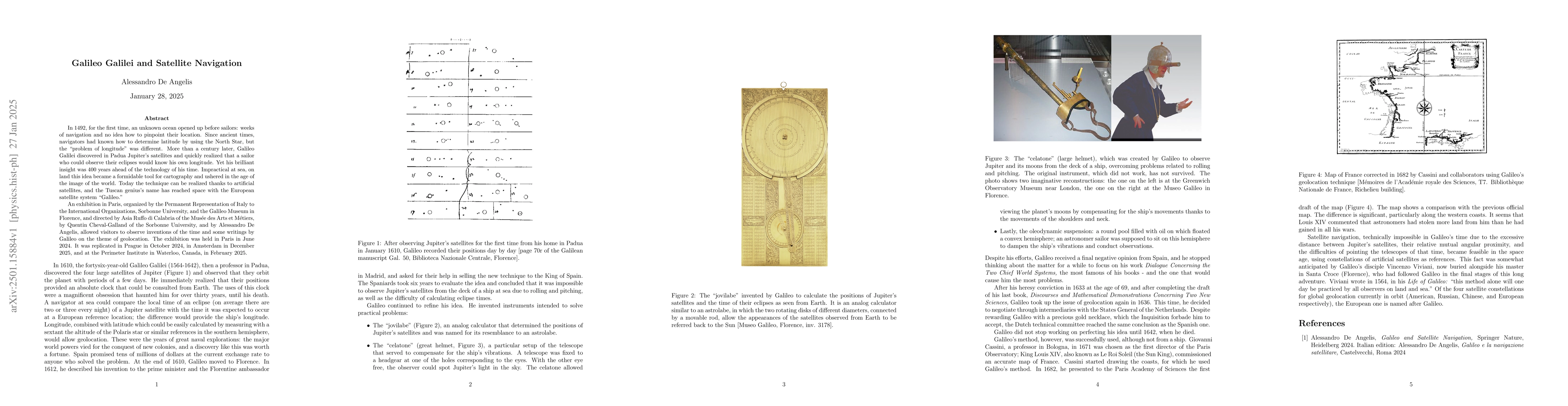
In 1492, for the first time, an unknown ocean opened up before sailors: weeks of navigation and no idea how to pinpoint their location. Since ancient times, navigators had known how to determine latitude by using the North Star, but the "problem of longitude" was different. More than a century later, Galileo Galilei discovered in Padua Jupiter's satellites and quickly realized that a sailor who could observe their eclipses would know his own longitude. Yet his brilliant insight was 400 years ahead of the technology of his time. Impractical at sea, on land this idea became a formidable tool for cartography and ushered in the age of the image of the world. Today the technique can be realized thanks to artificial satellites, and the Tuscan genius' name has reached space with the European satellite system named Galileo. An exhibition in Paris, organized by the Permanent Representation of Italy to the International Organizations, Sorbonne University, and the Galileo Museum in Florence, and directed by Asia Ruffo di Calabria of the Musee des Arts et Metiers, by Quentin Cheval-Galland of the Sorbonne University, and by Alessandro De Angelis, allowed visitors to observe inventions of the time and some writings by Galileo on the theme of geolocation. The exhibition was held in Paris in June 2024. It was replicated in Prague in October 2024, in Amsterdam in December 2025, and at the Perimeter Institute in Waterloo, Canada, in February 2025.
AI Key Findings
Get AI-generated insights about this paper's methodology, results, significance, and more — seven facets brought into focus.
Authors
PDF Preview
Related Papers
No references found for this paper.
Discussion 0