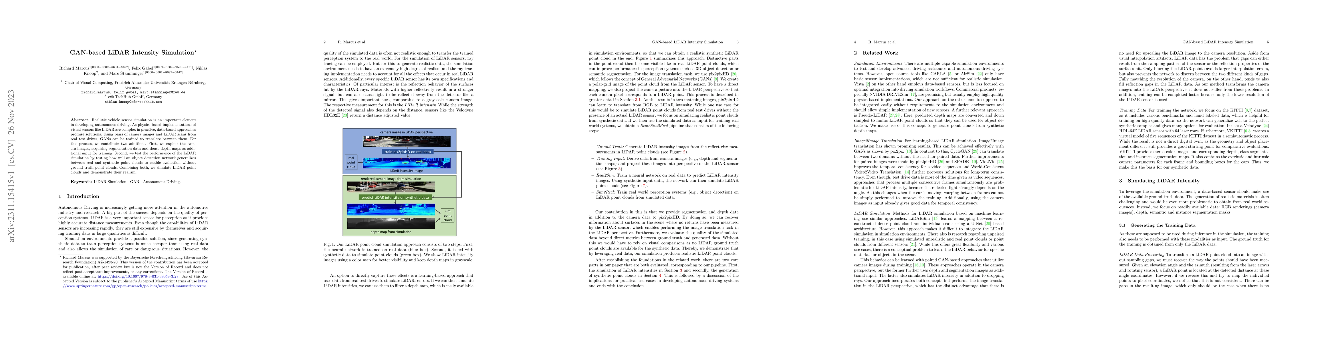
GAN-Based LiDAR Intensity Simulation
Publication
Metrics
AI Quick Summary
This paper proposes a GAN-based method for simulating realistic LiDAR intensity data using camera images, leveraging segmentation data and dense depth maps for training. The effectiveness is evaluated by testing object detection network generalization between real and synthetic point clouds, demonstrating the method's ability to produce realistic LiDAR simulations.
Paper Preview
Abstract
Realistic vehicle sensor simulation is an important element in developing autonomous driving. As physics-based implementations of visual sensors like LiDAR are complex in practice, data-based approaches promise solutions. Using pairs of camera images and LiDAR scans from real test drives, GANs can be trained to translate between them. For this process, we contribute two additions. First, we exploit the camera images, acquiring segmentation data and dense depth maps as additional input for training. Second, we test the performance of the LiDAR simulation by testing how well an object detection network generalizes between real and synthetic point clouds to enable evaluation without ground truth point clouds. Combining both, we simulate LiDAR point clouds and demonstrate their realism.
AI Key Findings
Get AI-generated insights about this paper's methodology, results, significance, and more — seven facets brought into focus.
Impact
Paper Details
Authors
PDF Preview
Key Terms
Citation Network
Current paper (gray), citations (green), references (blue)
Display is limited for performance on very large graphs.
Discussion 0