General algorithm of assigning raster features to vector maps at any resolution or scale
Publication
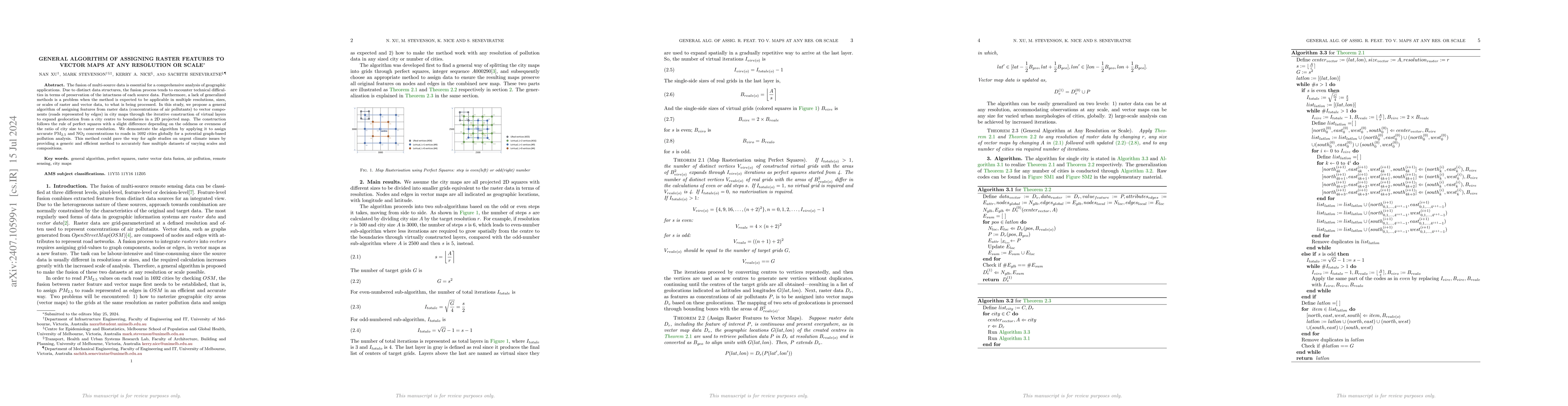
Metrics
AI Quick Summary
This paper proposes a generalized algorithm to accurately assign raster features, such as air pollutant concentrations, to vector maps like city road networks, regardless of resolution or scale. The algorithm utilizes iterative virtual layer construction and demonstrates its effectiveness by assigning PM$_{2.5}$ and NO$_{2}$ data to roads in 1692 global cities.
Paper Preview
Abstract
The fusion of multi-source data is essential for a comprehensive analysis of geographic applications. Due to distinct data structures, the fusion process tends to encounter technical difficulties in terms of preservation of the intactness of each source data. Furthermore, a lack of generalized methods is a problem when the method is expected to be applicable in multiple resolutions, sizes, or scales of raster and vector data, to what is being processed. In this study, we propose a general algorithm of assigning features from raster data (concentrations of air pollutants) to vector components (roads represented by edges) in city maps through the iterative construction of virtual layers to expand geolocation from a city centre to boundaries in a 2D projected map. The construction follows the rule of perfect squares with a slight difference depending on the oddness or evenness of the ratio of city size to raster resolution. We demonstrate the algorithm by applying it to assign accurate PM$_{2.5}$ and NO$_{2}$ concentrations to roads in 1692 cities globally for a potential graph-based pollution analysis. This method could pave the way for agile studies on urgent climate issues by providing a generic and efficient method to accurately fuse multiple datasets of varying scales and compositions.
AI Key Findings
Get AI-generated insights about this paper's methodology, results, significance, and more — seven facets brought into focus.
Authors
PDF Preview
Key Terms
Related Papers
No references found for this paper.
Discussion 0