Generate Your Own Scotland: Satellite Image Generation Conditioned on Maps
Publication
Metrics
AI Quick Summary
This paper explores the use of pretrained diffusion models conditioned on cartographic data to generate realistic satellite images, specifically focusing on the region of Mainland Scotland. The authors provide two large datasets and demonstrate the potential of their ControlNet model in generating high-quality satellite images while maintaining map fidelity.
Paper Preview
Abstract
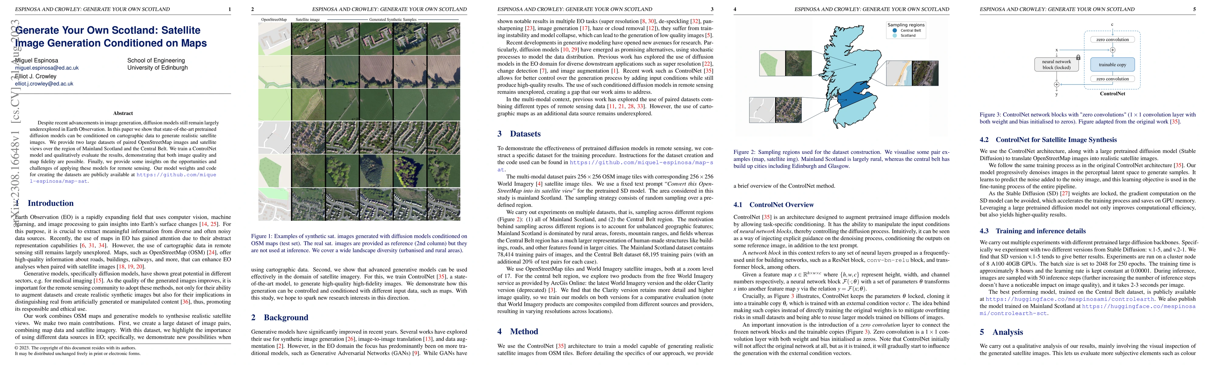
Despite recent advancements in image generation, diffusion models still remain largely underexplored in Earth Observation. In this paper we show that state-of-the-art pretrained diffusion models can be conditioned on cartographic data to generate realistic satellite images. We provide two large datasets of paired OpenStreetMap images and satellite views over the region of Mainland Scotland and the Central Belt. We train a ControlNet model and qualitatively evaluate the results, demonstrating that both image quality and map fidelity are possible. Finally, we provide some insights on the opportunities and challenges of applying these models for remote sensing. Our model weights and code for creating the dataset are publicly available at https://github.com/miquel-espinosa/map-sat.
AI Key Findings
Get AI-generated insights about this paper's methodology, results, significance, and more — seven facets brought into focus.
Impact
Paper Details
Authors
PDF Preview
Key Terms
Citation Network
Current paper (gray), citations (green), references (blue)
Display is limited for performance on very large graphs.
Discussion 0