Researchers developed a method to generate zoomable maps with rivers and fjords using recursive subdivision of triangles, enabling unlimited detail without high-resolution map generation.
This paper presents a method for generating maps with rivers and fjords. The method is based on recursive subdivision of triangles and allows unlimited zoom on details without requiring generation of a full map at high resolution.
Generated Jun 09, 2025
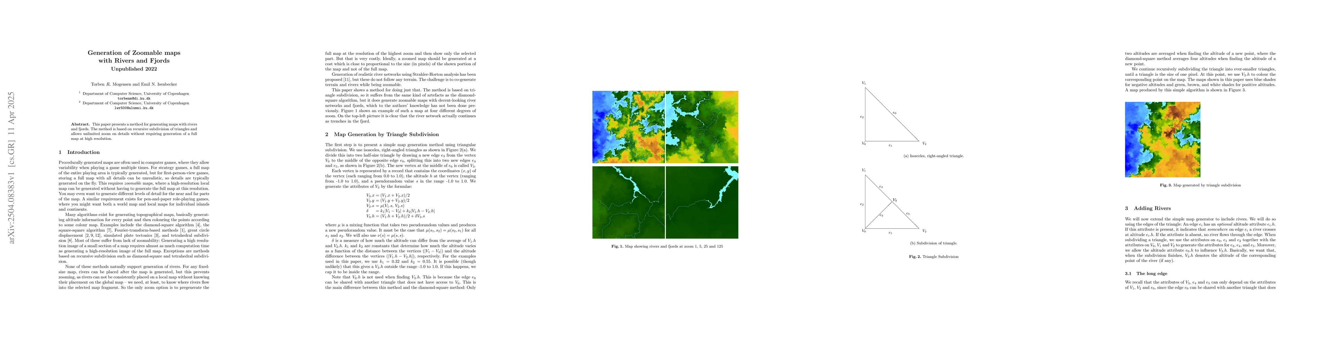
The paper presents a method for generating zoomable maps with rivers and fjords using recursive subdivision of triangles, avoiding the need for high-resolution map generation upfront.
This research is significant for applications in gaming, both computer and table-top, and potentially for creating detailed vegetation and climate models, though it currently only generates altitudes and rivers.
The primary technical contribution is a novel algorithm for recursive triangle subdivision to generate zoomable maps with rivers and fjords, incorporating rules for river placement that mimic natural river systems.
This work stands out by introducing a method for generating zoomable maps with rivers and fjords through recursive triangle subdivision, offering a different approach compared to traditional grid-based map generation methods.
Current paper (gray), citations (green), references (blue)
Display is limited for performance on very large graphs.
No citations found for this paper.
Comments (0)