GeoCMS : Towards a Geo-Tagged Media Management System
Publication
Metrics
AI Quick Summary
This paper introduces Open GeoCMS, a geo-tagged media management system designed to handle and organize large volumes of geo-tagged multimedia data, including geovideos and geophotos, with spatial and temporal metadata. The system supports various data types and features a label viewer and editor for enhanced user interaction.
Paper Preview
Abstract
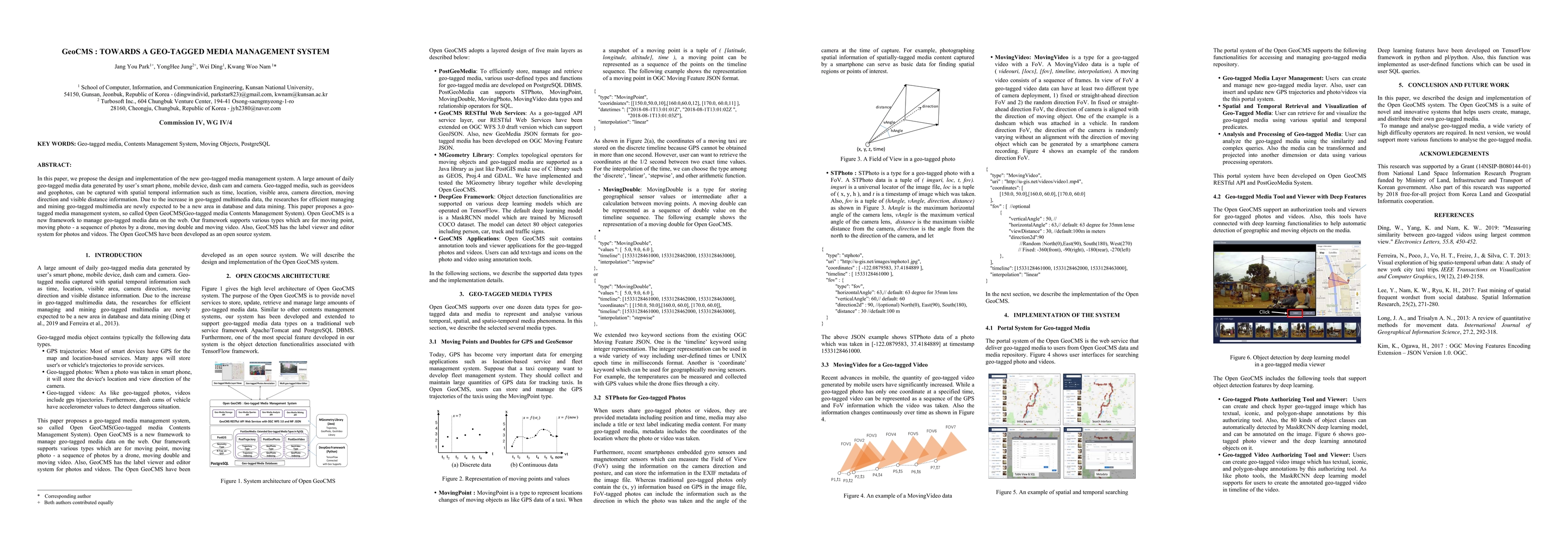
In this paper, we propose the design and implementation of the new geotagged media management system. A large amount of daily geo-tagged media data generated by user's smart phone, mobile device, dash cam and camera. Geotagged media, such as geovideos and geophotos, can be captured with spatial temporal information such as time, location, visible area, camera direction, moving direction and visible distance information. Due to the increase in geo-tagged multimedia data, the researches for efficient managing and mining geo-tagged multimedia are newly expected to be a new area in database and data mining. This paper proposes a geo-tagged media management system, so called Open GeoCMS(Geotagged media Contents Management System). Open GeoCMS is a new framework to manage geotagged media data on the web. Our framework supports various types which are for moving point, moving photo - a sequence of photos by a drone, moving double and moving video. Also, GeoCMS has the label viewer and editor system for photos and videos. The Open GeoCMS have been developed as an open source system.
AI Key Findings
Get AI-generated insights about this paper's methodology, results, significance, and more — seven facets brought into focus.
Impact
Paper Details
Authors
PDF Preview
Key Terms
Citation Network
Current paper (gray), citations (green), references (blue)
Display is limited for performance on very large graphs.
Discussion 0