Publication
Metrics
AI Quick Summary
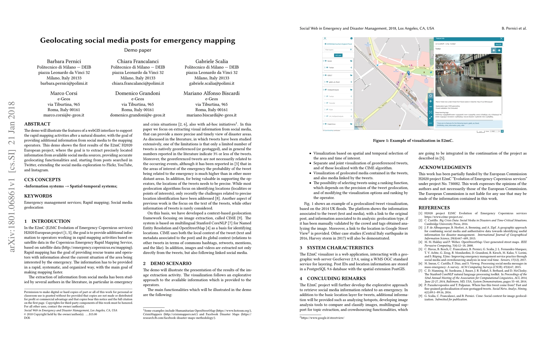
This research demonstrates a webGIS interface for rapid emergency mapping post-disaster, integrating geolocated information from social media platforms like Twitter, Flickr, YouTube, and Instagram to enhance mapping accuracy. The project aims to extract precise geolocation data from social media to support mapping operators.
Paper Preview
Abstract
The demo will illustrate the features of a webGIS interface to support the rapid mapping activities after a natural disaster, with the goal of providing additional information from social media to the mapping operators. This demo shows the first results of the E2mC H2020 European project, where the goal is to extract precisely located information from available social media sources, providing accurate geolocating functionalities and, starting from posts searched in Twitter, extending the social media exploration to Flickr, YouTube, and Instagram.
AI Key Findings
Get AI-generated insights about this paper's methodology, results, significance, and more — seven facets brought into focus.
Impact
Paper Details
PDF Preview
Key Terms
Citation Network
Current paper (gray), citations (green), references (blue)
Display is limited for performance on very large graphs.
Discussion 0