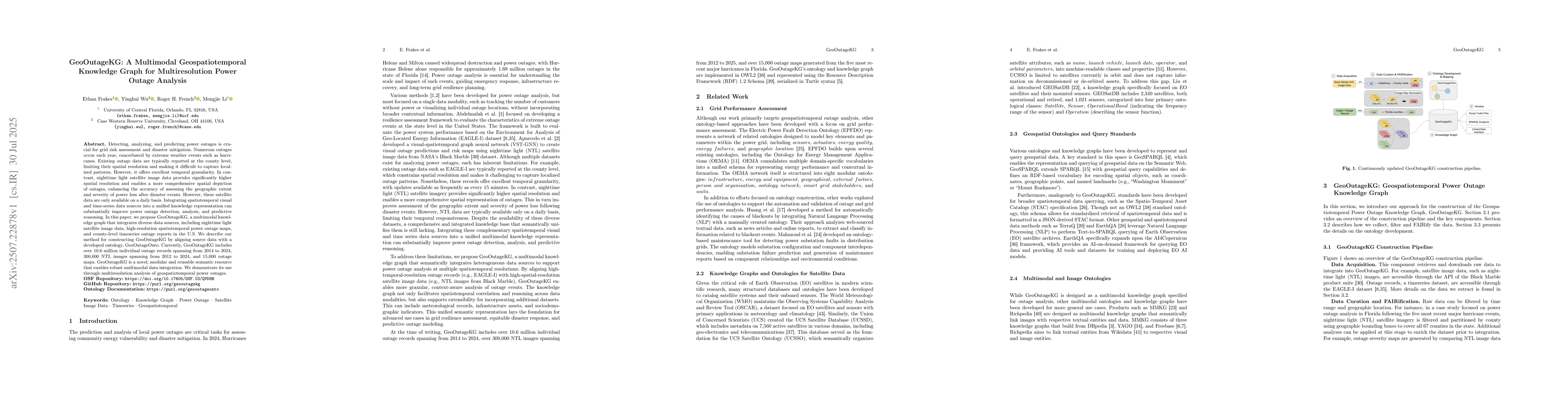
Detecting, analyzing, and predicting power outages is crucial for grid risk
assessment and disaster mitigation. Numerous outages occur each year,
exacerbated by extreme weather events such as hurricanes. Existing outage data
are typically reported at the county level, limiting their spatial resolution
and making it difficult to capture localized patterns. However, it offers
excellent temporal granularity. In contrast, nighttime light satellite image
data provides significantly higher spatial resolution and enables a more
comprehensive spatial depiction of outages, enhancing the accuracy of assessing
the geographic extent and severity of power loss after disaster events.
However, these satellite data are only available on a daily basis. Integrating
spatiotemporal visual and time-series data sources into a unified knowledge
representation can substantially improve power outage detection, analysis, and
predictive reasoning. In this paper, we propose GeoOutageKG, a multimodal
knowledge graph that integrates diverse data sources, including nighttime light
satellite image data, high-resolution spatiotemporal power outage maps, and
county-level timeseries outage reports in the U.S. We describe our method for
constructing GeoOutageKG by aligning source data with a developed ontology,
GeoOutageOnto. Currently, GeoOutageKG includes over 10.6 million individual
outage records spanning from 2014 to 2024, 300,000 NTL images spanning from
2012 to 2024, and 15,000 outage maps. GeoOutageKG is a novel, modular and
reusable semantic resource that enables robust multimodal data integration. We
demonstrate its use through multiresolution analysis of geospatiotemporal power
outages.
Discussion 0