GeoViT: A Versatile Vision Transformer Architecture for Geospatial Image Analysis
Publication
Metrics
AI Quick Summary
GeoViT is a compact vision transformer model designed for geospatial image analysis, achieving superior accuracy in estimating greenhouse gas emissions from satellite imagery. It outperforms previous models in tasks like CO2 and NO2 emissions quantification, highlighting the potential of vision transformers for climate change monitoring.
Paper Preview
Abstract
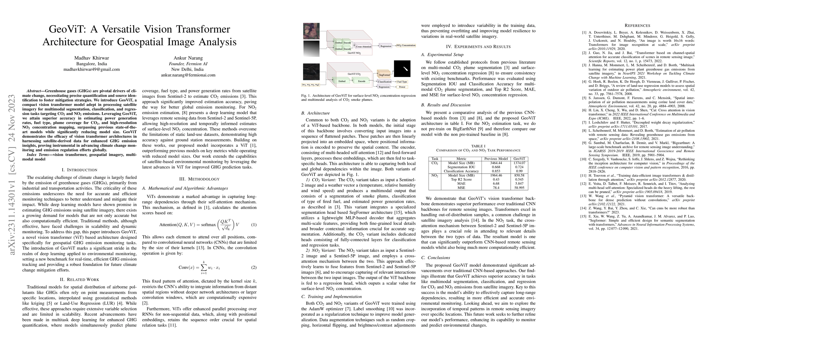
Greenhouse gases are pivotal drivers of climate change, necessitating precise quantification and source identification to foster mitigation strategies. We introduce GeoViT, a compact vision transformer model adept in processing satellite imagery for multimodal segmentation, classification, and regression tasks targeting CO2 and NO2 emissions. Leveraging GeoViT, we attain superior accuracy in estimating power generation rates, fuel type, plume coverage for CO2, and high-resolution NO2 concentration mapping, surpassing previous state-of-the-art models while significantly reducing model size. GeoViT demonstrates the efficacy of vision transformer architectures in harnessing satellite-derived data for enhanced GHG emission insights, proving instrumental in advancing climate change monitoring and emission regulation efforts globally.
AI Key Findings
Get AI-generated insights about this paper's methodology, results, significance, and more — seven facets brought into focus.
Impact
Paper Details
Authors
PDF Preview
Key Terms
Citation Network
Current paper (gray), citations (green), references (blue)
Display is limited for performance on very large graphs.
Discussion 0