Publication
Metrics
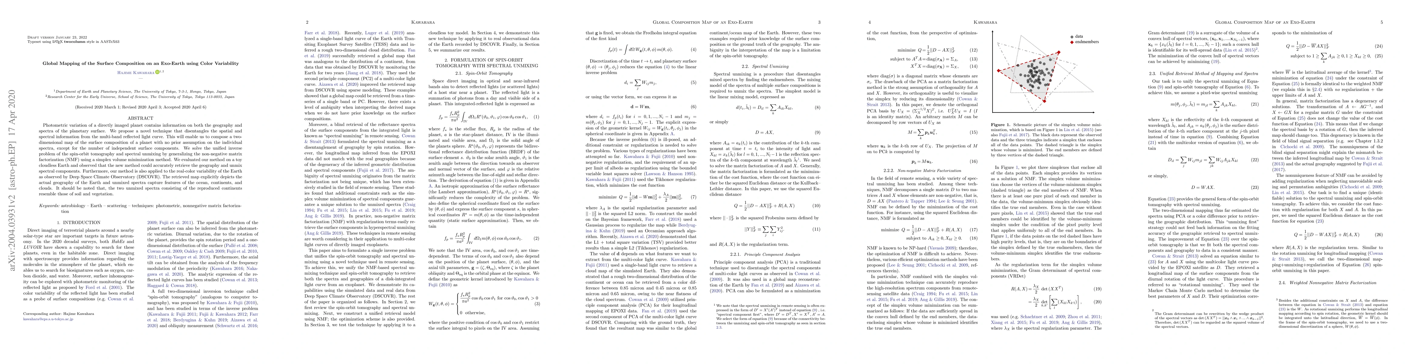
AI Quick Summary
A new technique uses color variability to create a 2D map of an exo-earth's surface composition without prior assumptions, successfully retrieving geography and unmixed spectra from real-color data of Earth and a simulated planet.
Paper Preview
Abstract
Photometric variation of a directly imaged planet contains information on both the geography and spectra of the planetary surface. We propose a novel technique that disentangles the spatial and spectral information from the multi-band reflected light curve. This will enable us to compose a two-dimensional map of the surface composition of a planet with no prior assumption on the individual spectra, except for the number of independent surface components. We solve the unified inverse problem of the spin-orbit tomography and spectral unmixing by generalizing the non-negative matrix factorization (NMF) using a simplex volume minimization method. We evaluated our method on a toy cloudless Earth and observed that the new method could accurately retrieve the geography and unmix spectral components. Furthermore, our method is also applied to the real-color variability of the Earth as observed by Deep Space Climate Observatory (DSCOVR). The retrieved map explicitly depicts the actual geography of the Earth and unmixed spectra capture features of the ocean, continents, and clouds. It should be noted that, the two unmixed spectra consisting of the reproduced continents resemble those of soil and vegetation.
AI Key Findings
Get AI-generated insights about this paper's methodology, results, significance, and more — seven facets brought into focus.
Impact
Paper Details
PDF Preview
Key Terms
Citation Network
Current paper (gray), citations (green), references (blue)
Display is limited for performance on very large graphs.
Discussion 0