Google street view and deep learning: a new ground truthing approach for crop mapping
Publication
Metrics
AI Quick Summary
This research explores the use of convolutional neural networks (CNNs) and Google Street View (GSV) images for automated ground truthing in crop mapping, demonstrating high accuracy and efficiency compared to traditional methods. The study successfully classified crop types in two regions, achieving 93% accuracy in California and 97% in Illinois, and showed strong agreement with USDA crop data.
Paper Preview
Abstract
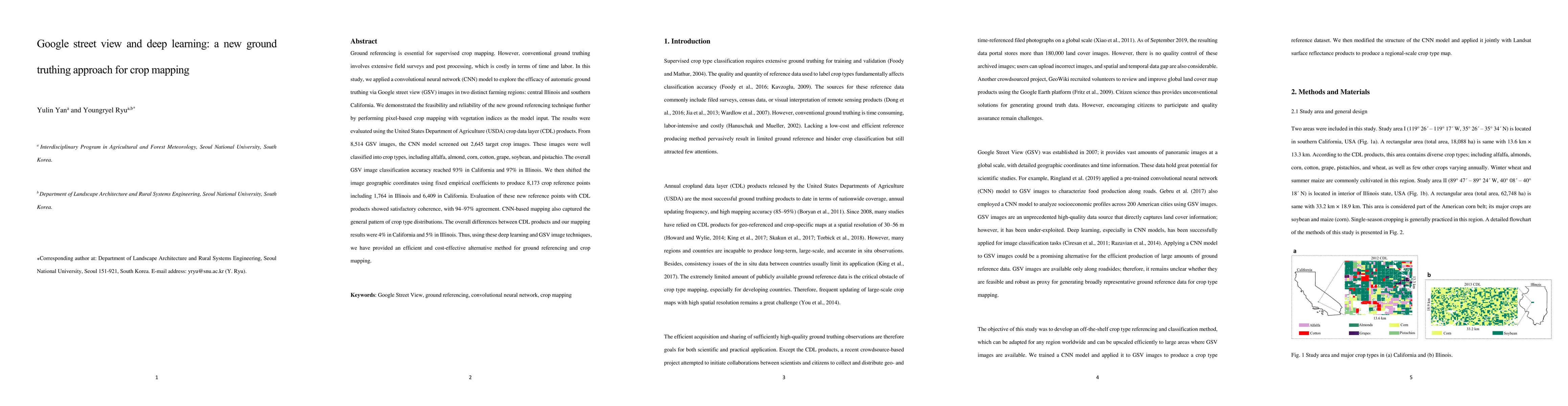
Ground referencing is essential for supervised crop mapping. However, conventional ground truthing involves extensive field surveys and post processing, which is costly in terms of time and labor. In this study, we applied a convolutional neural network (CNN) model to explore the efficacy of automatic ground truthing via Google street view (GSV) images in two distinct farming regions: central Illinois and southern California. We demonstrated the feasibility and reliability of the new ground referencing technique further by performing pixel-based crop mapping with vegetation indices as the model input. The results were evaluated using the United States Department of Agriculture (USDA) crop data layer (CDL) products. From 8,514 GSV images, the CNN model screened out 2,645 target crop images. These images were well classified into crop types, including alfalfa, almond, corn, cotton, grape, soybean, and pistachio. The overall GSV image classification accuracy reached 93% in California and 97% in Illinois. We then shifted the image geographic coordinates using fixed empirical coefficients to produce 8,173 crop reference points including 1,764 in Illinois and 6,409 in California. Evaluation of these new reference points with CDL products showed satisfactory coherence, with 94 to 97% agreement. CNN-based mapping also captured the general pattern of crop type distributions. The overall differences between CDL products and our mapping results were 4% in California and 5% in Illinois. Thus, using these deep learning and GSV image techniques, we have provided an efficient and cost-effective alternative method for ground referencing and crop mapping.
AI Key Findings
Get AI-generated insights about this paper's methodology, results, significance, and more — seven facets brought into focus.
Impact
Paper Details
Authors
PDF Preview
Key Terms
Citation Network
Current paper (gray), citations (green), references (blue)
Display is limited for performance on very large graphs.
Discussion 0