GPS-2-GTFS: A Python package to process and transform raw GPS data of public transit to GTFS format
Publication
Metrics
AI Quick Summary
Summary: The gps2gtfs Python package converts raw GPS data from public transit vehicles into the GTFS format, aiding software applications in tracking, scheduling, and predicting arrival times. It uses geo-buffer mapping, parallel processing, and data filtering to address challenges like data volume and errors.
Paper Preview
Abstract
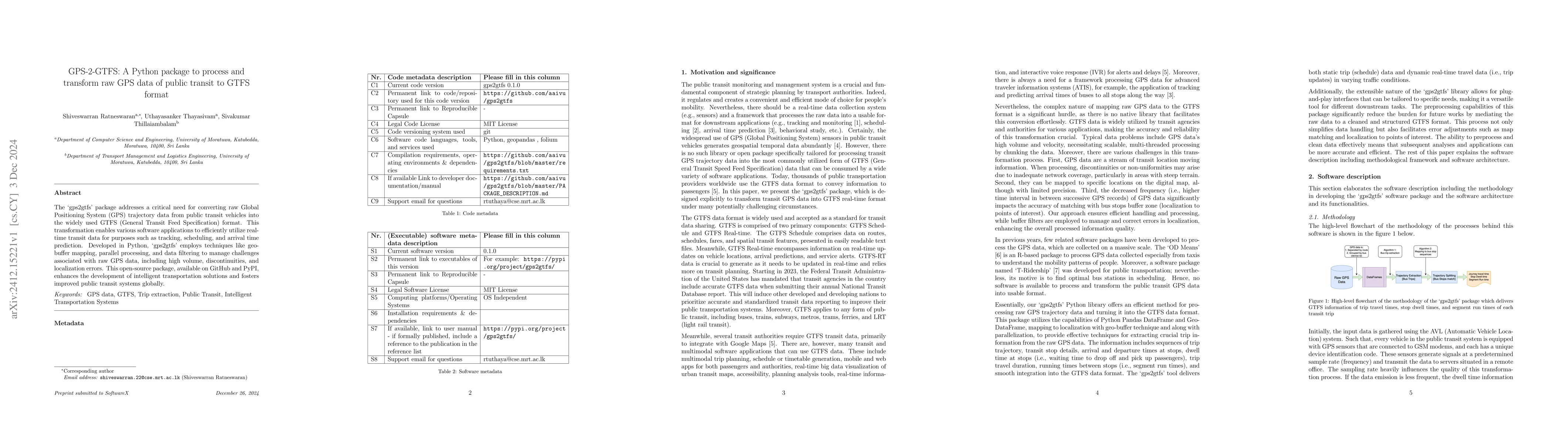
The gps2gtfs package addresses a critical need for converting raw Global Positioning System (GPS) trajectory data from public transit vehicles into the widely used GTFS (General Transit Feed Specification) format. This transformation enables various software applications to efficiently utilize real-time transit data for purposes such as tracking, scheduling, and arrival time prediction. Developed in Python, gps2gtfs employs techniques like geo-buffer mapping, parallel processing, and data filtering to manage challenges associated with raw GPS data, including high volume, discontinuities, and localization errors. This open-source package, available on GitHub and PyPI, enhances the development of intelligent transportation solutions and fosters improved public transit systems globally.
AI Key Findings
Get AI-generated insights about this paper's methodology, results, significance, and more — seven facets brought into focus.
Impact
Authors
PDF Preview
Citation Network
Current paper (gray), citations (green), references (blue)
Display is limited for performance on very large graphs.
Discussion 0