Publication
Metrics
AI Quick Summary
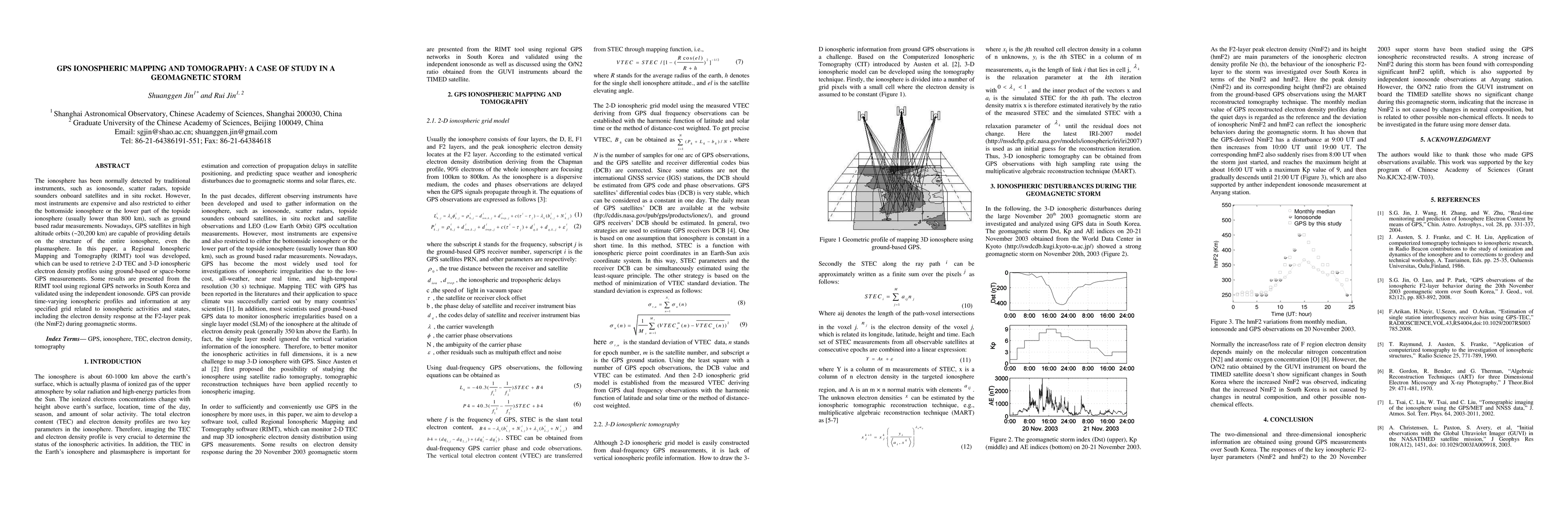
This paper develops a Regional Ionospheric Mapping and Tomography (RIMT) tool to retrieve 2-D TEC and 3-D ionospheric electron density profiles using GPS measurements, demonstrating its effectiveness during geomagnetic storms in South Korea. The results are validated using independent ionosonde data.
Paper Preview
Abstract
The ionosphere has been normally detected by traditional instruments, such as ionosonde, scatter radars, topside sounders onboard satellites and in situ rocket. However, most instruments are expensive and also restricted to either the bottomside ionosphere or the lower part of the topside ionosphere (usually lower than 800 km), such as ground based radar measurements. Nowadays, GPS satellites in high altitude orbits (~20,200 km) are capable of providing details on the structure of the entire ionosphere, even the plasmasphere. In this paper, a Regional Ionospheric Mapping and Tomography (RIMT) tool was developed, which can be used to retrieve 2-D TEC and 3-D ionospheric electron density profiles using ground-based or space-borne GPS measurements. Some results are presented from the RIMT tool using regional GPS networks in South Korea and validated using the independent ionosonde. GPS can provide time-varying ionospheric profiles and information at any specified grid related to ionospheric activities and states, including the electron density response at the F2-layer peak (the NmF2) during geomagnetic storms.
AI Key Findings
Get AI-generated insights about this paper's methodology, results, significance, and more — seven facets brought into focus.
Impact
Paper Details
PDF Preview
Key Terms
Citation Network
Current paper (gray), citations (green), references (blue)
Display is limited for performance on very large graphs.
Discussion 0