ArxivLens
ArXiv cs.AI

GPSBench: Do Large Language Models Understand GPS Coordinates?

Jey Han Lau, Jianzhong Qi, Thinh Hung Truong

2602.16105 Published Feb 18, 2026
View PDF

Publication

Published: Feb 18, 2026
Categories: cs.AI

Metrics

Source: ArXiv

Quick Answers

What methodology did the authors use?

The authors constructed GPSBench, a 57,800‑sample dataset covering 17 geospatial tasks (coordinate conversion, distance, bearing, interpolation, polygon area, etc.) with balanced geographic sampling. They evaluated 14 state‑of‑the‑art LLMs in zero‑shot and fine‑tuned settings, measuring accuracy on each task and analyzing scaling, noise robustness, and trade‑offs. More in Methodology →

What are the key results?

LLMs perform better on applied world‑knowledge tasks than on pure geometric coordinate computations, with country‑level accuracy high but city‑level localization weak. — Fine‑tuning improves geometric accuracy but consistently degrades world‑knowledge recall, revealing a clear trade‑off between coordinate skill and geographic knowledge. More in Key Results →

Why is this work significant?

GPSBench provides the first systematic benchmark for GPS coordinate reasoning, enabling developers to assess and improve LLMs for navigation, robotics, and mapping applications, and to understand the limits of current models before deployment. More in Significance →

What are the main limitations?

Evaluation is limited to text‑only LLMs and English prompts, excluding multimodal or cross‑lingual capabilities. — Geographic coverage relies on GeoNames, biasing toward urban areas and omitting maritime, polar, and desert regions, which may affect generalizability. More in Limitations →

Paper Preview

Abstract

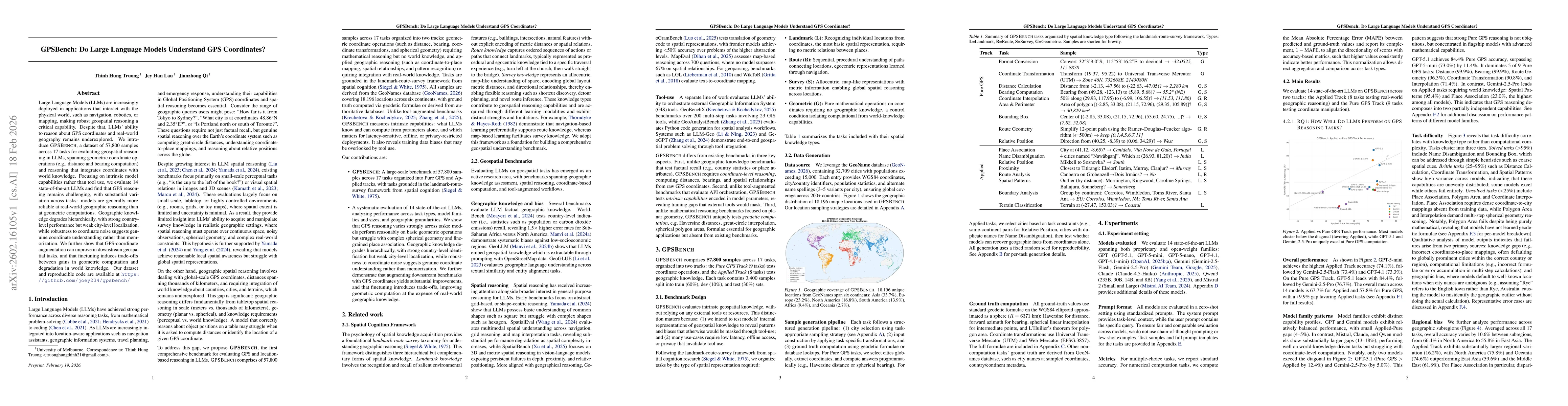
Large Language Models (LLMs) are increasingly deployed in applications that interact with the physical world, such as navigation, robotics, or mapping, making robust geospatial reasoning a critical capability. Despite that, LLMs' ability to reason about GPS coordinates and real-world geography remains underexplored. We introduce GPSBench, a dataset of 57,800 samples across 17 tasks for evaluating geospatial reasoning in LLMs, spanning geometric coordinate operations (e.g., distance and bearing computation) and reasoning that integrates coordinates with world knowledge. Focusing on intrinsic model capabilities rather than tool use, we evaluate 14 state-of-the-art LLMs and find that GPS reasoning remains challenging, with substantial variation across tasks: models are generally more reliable at real-world geographic reasoning than at geometric computations. Geographic knowledge degrades hierarchically, with strong country-level performance but weak city-level localization, while robustness to coordinate noise suggests genuine coordinate understanding rather than memorization. We further show that GPS-coordinate augmentation can improve in downstream geospatial tasks, and that finetuning induces trade-offs between gains in geometric computation and degradation in world knowledge. Our dataset and reproducible code are available at https://github.com/joey234/gpsbench

Key Findings, in focus

Seven facets of this paper, analysed and brought into focus by AI.

AI-generated · verify against source Generated Feb 19, 2026
In focus · one-line synthesis

GPSBench provides the first systematic benchmark for GPS coordinate reasoning, enabling developers to assess and improve LLMs for navigation, robotics, and mapping applications, and to understand the limits of current models before deployment.

01
MethodologyHow they did it

The authors constructed GPSBench, a 57,800‑sample dataset covering 17 geospatial tasks (coordinate conversion, distance, bearing, interpolation, polygon area, etc.) with balanced geographic sampling. They evaluated 14 state‑of‑the‑art LLMs in zero‑shot and fine‑tuned settings, measuring accuracy on each task and analyzing scaling, noise robustness, and trade‑offs.

02
ResultsWhat they found
  • LLMs perform better on applied world‑knowledge tasks than on pure geometric coordinate computations, with country‑level accuracy high but city‑level localization weak.
  • Fine‑tuning improves geometric accuracy but consistently degrades world‑knowledge recall, revealing a clear trade‑off between coordinate skill and geographic knowledge.
  • Model scaling benefits overall GPS reasoning, but gains vary by architecture; MoE models (e.g., Qwen3‑30B) achieve near‑zero gaps while large dense models (e.g., Mistral‑Large) show larger gaps.
03
SignificanceWhy it matters

GPSBench provides the first systematic benchmark for GPS coordinate reasoning, enabling developers to assess and improve LLMs for navigation, robotics, and mapping applications, and to understand the limits of current models before deployment.

04
Technical ContributionsWhat's new technically

A comprehensive GPSBench dataset, evaluation framework, and systematic analysis of LLM GPS reasoning across geometric and knowledge tasks, revealing scaling dynamics, noise robustness, and fine‑tuning trade‑offs.

05
NoveltyWhat sets it apart

First large‑scale, task‑diverse benchmark focused on GPS coordinate reasoning, uncovering hierarchical performance degradation and architecture‑specific trade‑offs that were previously unquantified.

06
LimitationsWhat to be cautious about
  • Evaluation is limited to text‑only LLMs and English prompts, excluding multimodal or cross‑lingual capabilities.
  • Geographic coverage relies on GeoNames, biasing toward urban areas and omitting maritime, polar, and desert regions, which may affect generalizability.
07
Future WorkWhere it goes next
  • Investigate continual learning or adapter methods to preserve base knowledge while adding GPS skills without degrading world‑knowledge.
  • Extend the benchmark with multimodal inputs (maps, satellite imagery) and underrepresented regions to broaden applicability.

Paper Details

Paper ID: 2602.16105
Categories:
cs.AI

How to Cite This Paper

Reference manager: RIS EndNote

Related Papers

4 found


Discussion 0

This website uses cookies to ensure you get the best experience. Learn more