Summary

In the aftermath of disasters, many institutions worldwide face challenges in continually monitoring changes in disaster risk, limiting the ability of key decision-makers to assess progress towards the UN Sendai Framework for Disaster Risk Reduction 2015-2030. While numerous efforts have substantially advanced the large-scale modeling of hazard and exposure through Earth observation and data-driven methods, progress remains limited in modeling another equally important yet challenging element of the risk equation: physical vulnerability. To address this gap, we introduce Graph Categorical Structured Variational Autoencoder (GraphCSVAE), a novel probabilistic data-driven framework for modeling physical vulnerability by integrating deep learning, graph representation, and categorical probabilistic inference, using time-series satellite-derived datasets and prior expert belief systems. We introduce a weakly supervised first-order transition matrix that reflects the changes in the spatiotemporal distribution of physical vulnerability in two 
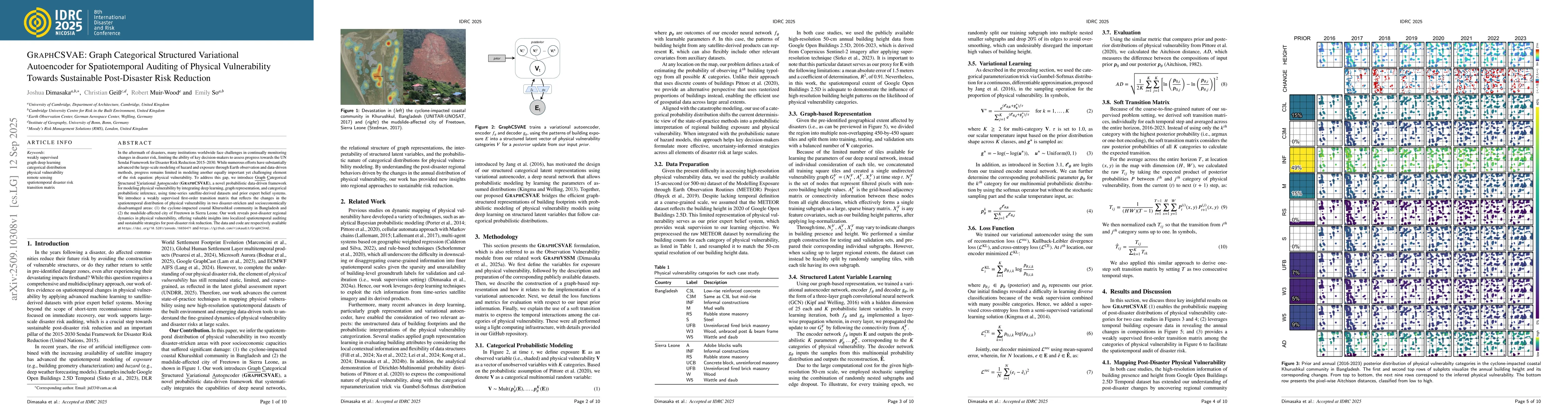
disaster-stricken and socioeconomically disadvantaged areas: (1) the cyclone-impacted coastal Khurushkul community in Bangladesh and (2) the mudslide-affected city of Freetown in Sierra Leone. Our work reveals post-disaster regional dynamics in physical vulnerability, offering valuable insights into localized spatiotemporal auditing and sustainable strategies for post-disaster risk reduction.

AI Key Findings

Generated Oct 03, 2025

Methodology

The study employs a graph-based variational autoencoder (GRAPHCSVAE) combined with time-series satellite data and coarse-grained prior information to derive a weakly supervised first-order transition matrix for analyzing regional disaster vulnerability dynamics.

Key Results

  • Identified persistent spatial-temporal patterns in post-disaster settlement behavior in Bangladesh and Sierra Leone
  • Demonstrated the potential of GRAPHCSVAE for auditing regional physical vulnerability distributions
  • Revealed self-loop dominance in vulnerability categories indicating stable settlement patterns

Significance

This research provides critical insights for disaster risk reduction planning under the Sendai Framework, offering a framework for assessing and monitoring regional vulnerability dynamics with satellite data.

Technical Contribution

Developed a unified framework integrating deep learning, graph representation, and categorical probabilistic inference for spatiotemporal vulnerability analysis.

Novelty

Introduces GRAPHCSVAE as a novel approach combining variational inference with graph structures for dynamic exposure and vulnerability modeling in disaster risk assessment.

Limitations

  • Relies on coarse-grained prior information limiting building-level calibration
  • Requires more comprehensive data for higher-order analysis

Future Work

  • Incorporate building-level information for more accurate higher-order analysis
  • Expand to other disaster-prone regions for broader applicability
  • Integrate multi-source data for improved vulnerability assessment

Paper Details

PDF Preview

Download PDF

Comments (0)

This website uses cookies to ensure you get the best experience. Learn more