01
MethodologyHow they did it
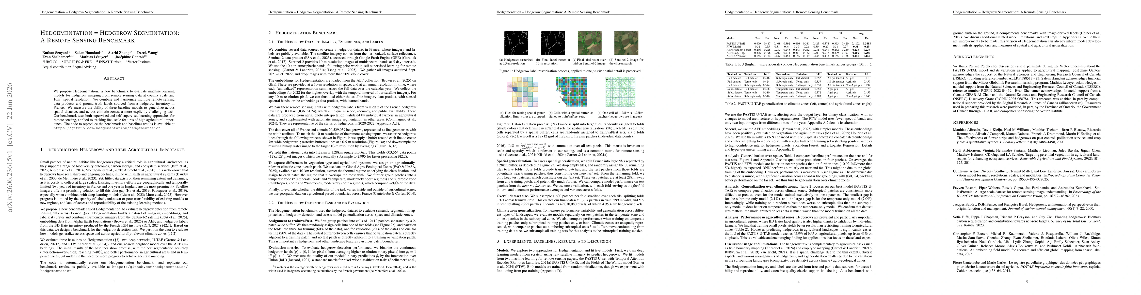
The paper introduces Hedgementation, a remote-sensing benchmark for hedgerow segmentation at country scale. It harmonizes Sentinel-2 imagery with AE embeddings and a French hedgerow inventory, creating 128x128 patches (subsampled to 2,995) annotated at 10 m resolution. It partitions data into 5 folds for training/validation/testing with spatial buffers to avoid leakage, and evaluates semantic segmentation models on IoU, comparing baseline architectures (U-TAE, FTW) and a nearest-neighbor baseline across climatic zones and agricultural productivity regions.
Discussion 0