Publication
Metrics
Paper Preview
Abstract
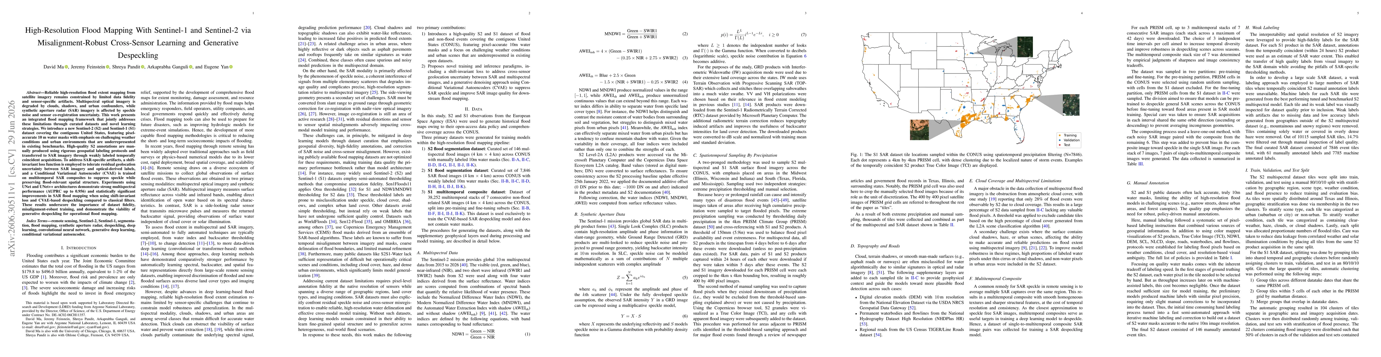
Reliable high-resolution flood extent mapping from satellite imagery remains constrained by limited data fidelity and sensor-specific artifacts. Multispectral optical imagery is degraded by clouds, shadows, and urban confounders, while synthetic aperture radar (SAR) imagery is affected by speckle noise and sensor co-registration uncertainty. This work presents an integrated flood mapping framework that jointly addresses these limitations through curated datasets and novel learning strategies. We introduce a new Sentinel-2 (S2) and Sentinel-1 (S1) dataset covering the contiguous United States, featuring pixel-accurate 10 m water masks with emphasis on challenging weather conditions and urban environments that are underrepresented in existing benchmarks. High-quality S2 annotations are manually produced using rigorous geospatial labeling protocols and transferred to SAR imagery through weakly labeled temporally coincident acquisitions. To address SAR-specific artifacts, a shift-invariant loss function is employed to tolerate residual geolocation uncertainty between SAR imagery and optical-derived labels, and a Conditional Variational Autoencoder (CVAE) is trained on multitemporal SAR composites to suppress speckle while preserving flood-relevant spatial structure. Experiments using UNet and UNet++ architectures demonstrate strong multispectral performance (AUPRC up to 0.956) and statistically significant improvements in SAR flood mapping when using shift-invariant loss and CVAE-based despeckling compared to classical filters. These results underscore the importance of dataset fidelity, misalignment-robust training, and demonstrate the viability of generative despeckling for operational flood mapping.
AI Key Findings
Get AI-generated insights about this paper's methodology, results, significance, and more — seven facets brought into focus.
Discussion 0