Holistically-Nested Structure-Aware Graph Neural Network for Road Extraction
Publication
Metrics
AI Quick Summary
This paper introduces a novel multi-task graph neural network (GNN) for road extraction from satellite images, which concurrently detects road regions and borders to enhance road connectivity and improve accuracy, outperforming existing CNN-based methods. Experiments show significant improvements in road border delineation and extraction accuracy.
Paper Preview
Abstract
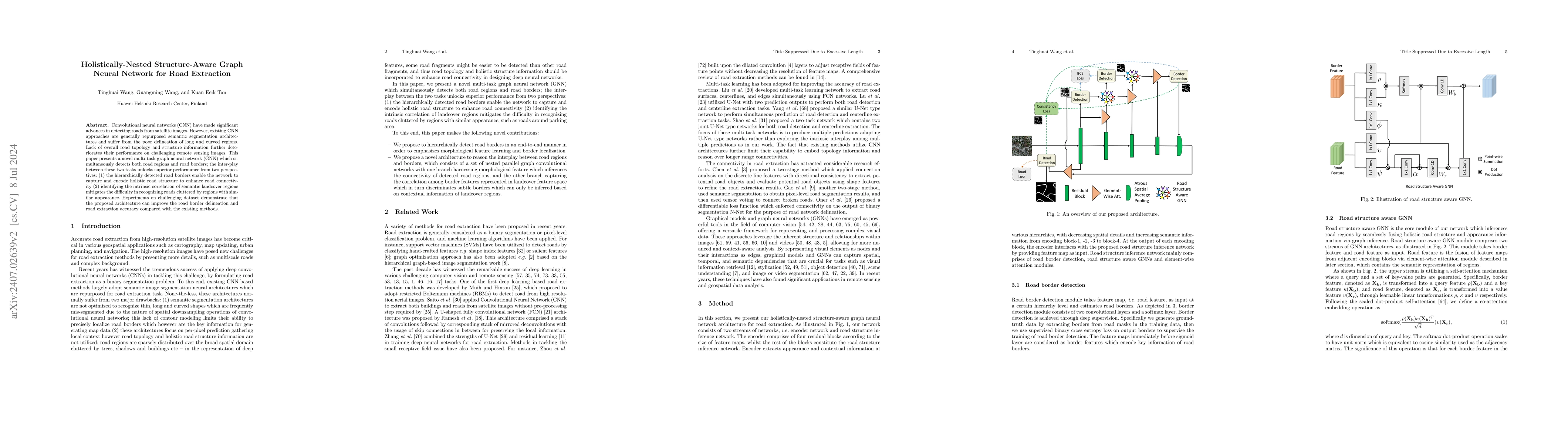
Convolutional neural networks (CNN) have made significant advances in detecting roads from satellite images. However, existing CNN approaches are generally repurposed semantic segmentation architectures and suffer from the poor delineation of long and curved regions. Lack of overall road topology and structure information further deteriorates their performance on challenging remote sensing images. This paper presents a novel multi-task graph neural network (GNN) which simultaneously detects both road regions and road borders; the inter-play between these two tasks unlocks superior performance from two perspectives: (1) the hierarchically detected road borders enable the network to capture and encode holistic road structure to enhance road connectivity (2) identifying the intrinsic correlation of semantic landcover regions mitigates the difficulty in recognizing roads cluttered by regions with similar appearance. Experiments on challenging dataset demonstrate that the proposed architecture can improve the road border delineation and road extraction accuracy compared with the existing methods.
AI Key Findings
Get AI-generated insights about this paper's methodology, results, significance, and more — seven facets brought into focus.
Impact
Authors
PDF Preview
Key Terms
Citation Network
Current paper (gray), citations (green), references (blue)
Display is limited for performance on very large graphs.
Discussion 0