Identification and Classification of Phenomena in Multispectral Satellite Imagery Using a New Image Smoother Method and its Applications in Environmental Remote Sensing
Publication
Metrics
Paper Preview
Abstract
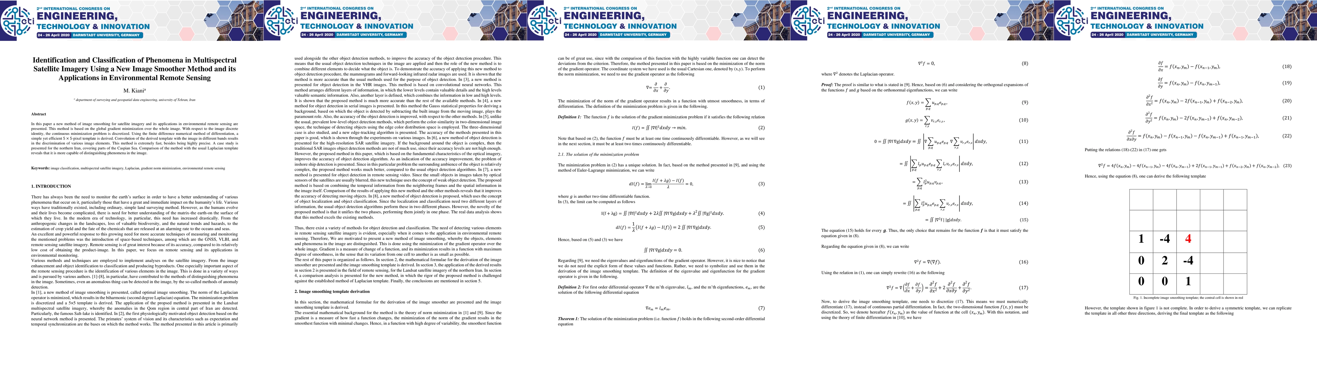
In this paper a new method of image smoothing for satellite imagery and its applications in environmental remote sensing are presented. This method is based on the global gradient minimization over the whole image. With respect to the image discrete identity, the continuous minimization problem is discretized. Using the finite difference numerical method of differentiation, a simple yet efficient 5*5-pixel template is derived. Convolution of the derived template with the image in different bands results in the discrimination of various image elements. This method is extremely fast, besides being highly precise. A case study is presented for the northern Iran, covering parts of the Caspian Sea. Comparison of the method with the usual Laplacian template reveals that it is more capable of distinguishing phenomena in the image.
AI Key Findings
Get AI-generated insights about this paper's methodology, results, significance, and more — seven facets brought into focus.
Impact
Paper Details
Authors
PDF Preview
Key Terms
Citation Network
Current paper (gray), citations (green), references (blue)
Display is limited for performance on very large graphs.
Discussion 0