Summary
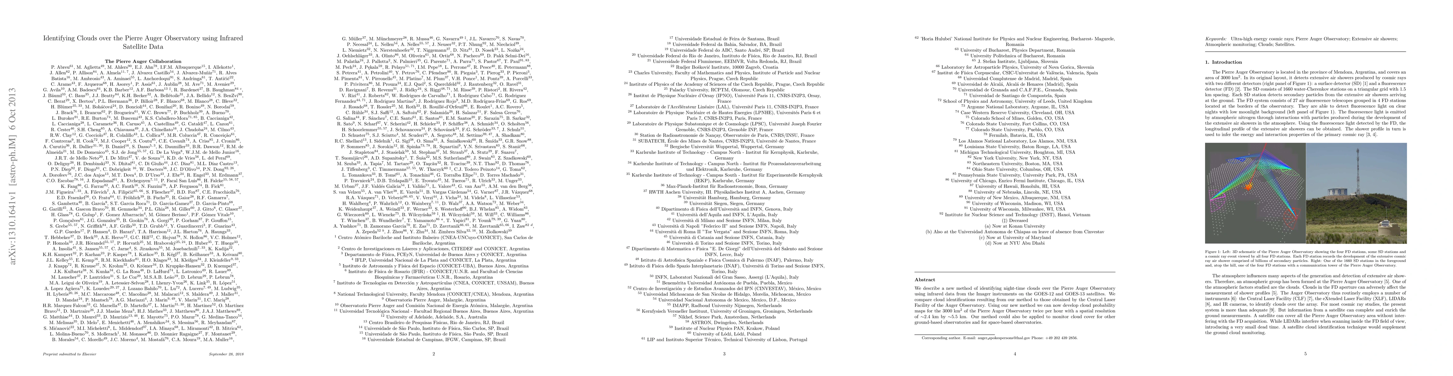
We describe a new method of identifying night-time clouds over the Pierre Auger Observatory using infrared data from the Imager instruments on the GOES-12 and GOES-13 satellites. We compare cloud identifications resulting from our method to those obtained by the Central Laser Facility of the Auger Observatory. Using our new method we can now develop cloud probability maps for the 3000 km^2 of the Pierre Auger Observatory twice per hour with a spatial resolution of ~2.4 km by ~5.5 km. Our method could also be applied to monitor cloud cover for other ground-based observatories and for space-based observatories.
AI Key Findings
Get AI-generated insights about this paper's methodology, results, and significance.
Paper Details
PDF Preview
Key Terms
Citation Network
Current paper (gray), citations (green), references (blue)
Display is limited for performance on very large graphs.
Similar Papers
Found 4 papers| Title | Authors | Year | Actions |
|---|
Comments (0)