Authors
Summary
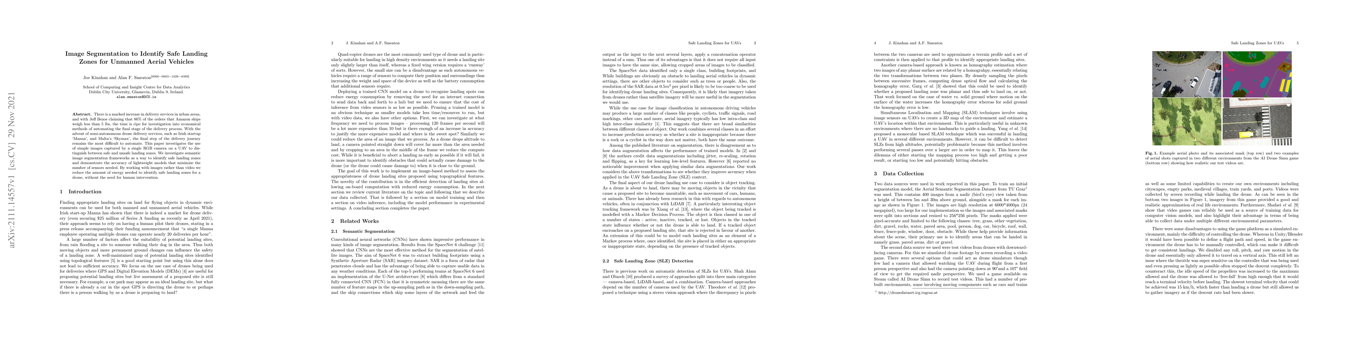
There is a marked increase in delivery services in urban areas, and with Jeff Bezos claiming that 86% of the orders that Amazon ships weigh less than 5 lbs, the time is ripe for investigation into economical methods of automating the final stage of the delivery process. With the advent of semi-autonomous drone delivery services, such as Irish startup `Manna', and Malta's `Skymax', the final step of the delivery journey remains the most difficult to automate. This paper investigates the use of simple images captured by a single RGB camera on a UAV to distinguish between safe and unsafe landing zones. We investigate semantic image segmentation frameworks as a way to identify safe landing zones and demonstrate the accuracy of lightweight models that minimise the number of sensors needed. By working with images rather than video we reduce the amount of energy needed to identify safe landing zones for a drone, without the need for human intervention.
AI Key Findings
Get AI-generated insights about this paper's methodology, results, and significance.
Paper Details
PDF Preview
Key Terms
Citation Network
Current paper (gray), citations (green), references (blue)
Display is limited for performance on very large graphs.
Similar Papers
Found 4 papersAn Integrated Visual System for Unmanned Aerial Vehicles Tracking and Landing on the Ground Vehicles
Kangcheng Liu
VisLanding: Monocular 3D Perception for UAV Safe Landing via Depth-Normal Synergy
Yuxiang Ji, Boyong He, Zhuoyue Tan et al.
| Title | Authors | Year | Actions |
|---|
Comments (0)