Imaging and Classification Techniques for Seagrass Mapping and Monitoring: A Comprehensive Survey
Publication
Metrics
AI Quick Summary
This paper surveys recent techniques for seagrass detection and mapping, focusing on still images, video data, acoustic images, and spectral images. It identifies research gaps such as the need for cost-effective, robust imaging methods and fully automated, real-time detection systems, suggesting future research should prioritize developing cheaper data collection techniques and deep learning-based classification.
Paper Preview
Abstract
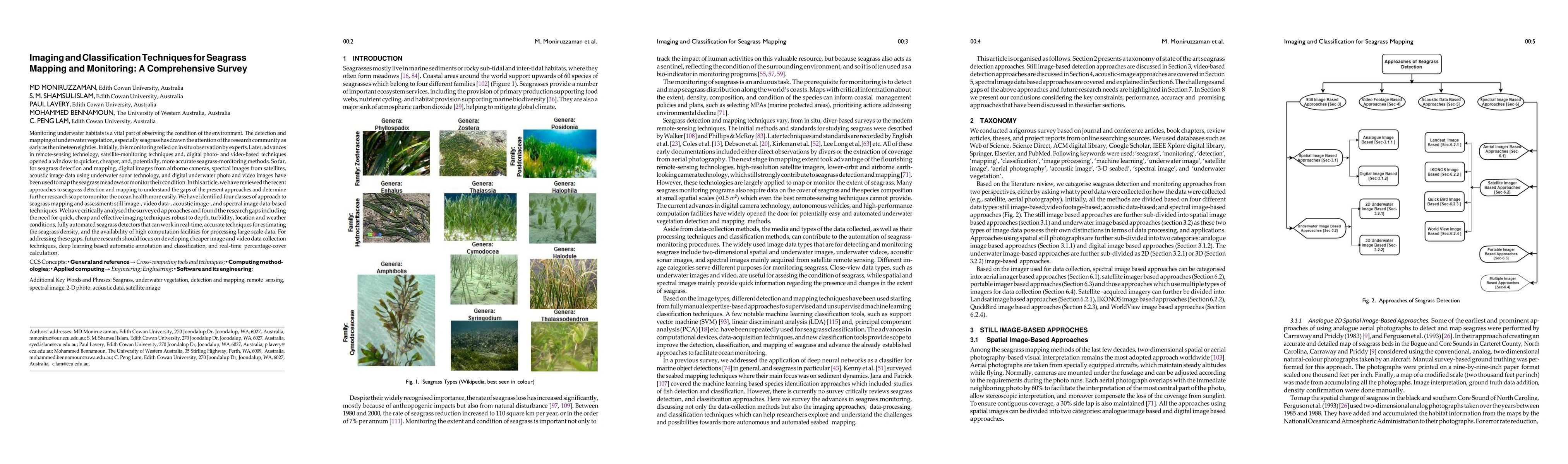
Monitoring underwater habitats is a vital part of observing the condition of the environment. The detection and mapping of underwater vegetation, especially seagrass has drawn the attention of the research community as early as the nineteen eighties. Initially, this monitoring relied on in situ observation by experts. Later, advances in remote-sensing technology, satellite-monitoring techniques and, digital photo- and video-based techniques opened a window to quicker, cheaper, and, potentially, more accurate seagrass-monitoring methods. So far, for seagrass detection and mapping, digital images from airborne cameras, spectral images from satellites, acoustic image data using underwater sonar technology, and digital underwater photo and video images have been used to map the seagrass meadows or monitor their condition. In this article, we have reviewed the recent approaches to seagrass detection and mapping to understand the gaps of the present approaches and determine further research scope to monitor the ocean health more easily. We have identified four classes of approach to seagrass mapping and assessment: still image-, video data-, acoustic image-, and spectral image data-based techniques. We have critically analysed the surveyed approaches and found the research gaps including the need for quick, cheap and effective imaging techniques robust to depth, turbidity, location and weather conditions, fully automated seagrass detectors that can work in real-time, accurate techniques for estimating the seagrass density, and the availability of high computation facilities for processing large scale data. For addressing these gaps, future research should focus on developing cheaper image and video data collection techniques, deep learning based automatic annotation and classification, and real-time percentage-cover calculation.
AI Key Findings
Get AI-generated insights about this paper's methodology, results, significance, and more — seven facets brought into focus.
Impact
Paper Details
PDF Preview
Key Terms
Citation Network
Current paper (gray), citations (green), references (blue)
Display is limited for performance on very large graphs.
Discussion 0