Publication
Metrics
AI Quick Summary
This paper explores using mobile phone data to infer land use patterns by analyzing the spatiotemporal distribution of population. It employs machine learning to identify clusters of similar land use and mobile phone activity, demonstrating that mobile phone data can provide valuable insights into actual land use that complements traditional zoning regulations.
Paper Preview
Abstract
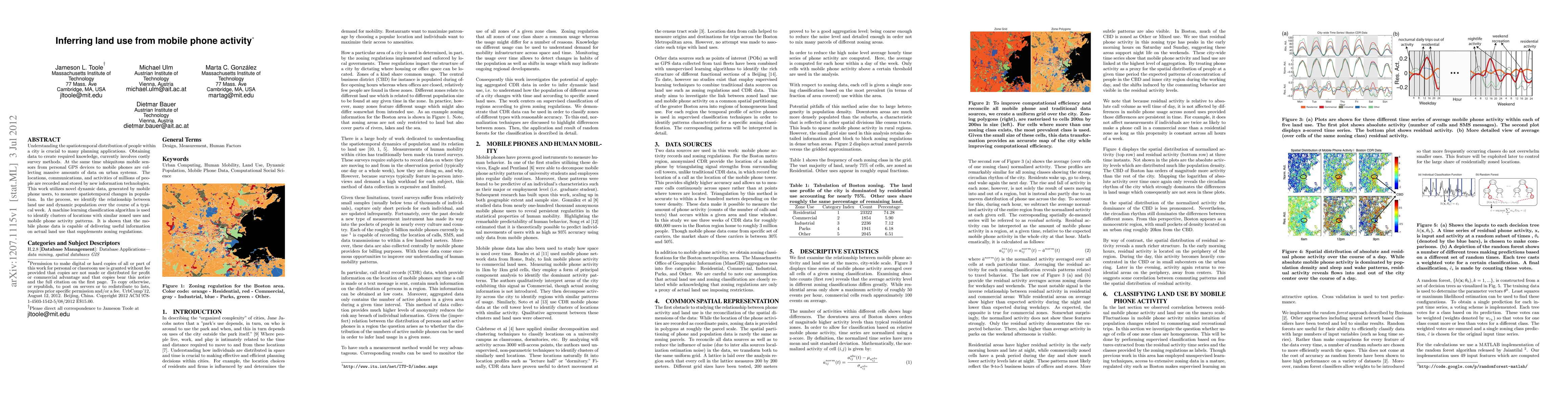
Understanding the spatiotemporal distribution of people within a city is crucial to many planning applications. Obtaining data to create required knowledge, currently involves costly survey methods. At the same time ubiquitous mobile sensors from personal GPS devices to mobile phones are collecting massive amounts of data on urban systems. The locations, communications, and activities of millions of people are recorded and stored by new information technologies. This work utilizes novel dynamic data, generated by mobile phone users, to measure spatiotemporal changes in population. In the process, we identify the relationship between land use and dynamic population over the course of a typical week. A machine learning classification algorithm is used to identify clusters of locations with similar zoned uses and mobile phone activity patterns. It is shown that the mobile phone data is capable of delivering useful information on actual land use that supplements zoning regulations.
AI Key Findings
Get AI-generated insights about this paper's methodology, results, significance, and more — seven facets brought into focus.
Impact
Paper Details
PDF Preview
Key Terms
Citation Network
Current paper (gray), citations (green), references (blue)
Display is limited for performance on very large graphs.
Discussion 0