AI Quick Summary
This paper proposes a novel informative path planning method using coregionalized Gaussian processes with a spatiotemporal kernel to dynamically reconstruct scalar fields. The method improves accuracy by accounting for spatiotemporal correlations and is shown to outperform previous methods through extensive simulations.
Quick Answers
What methodology did the authors use?
The research employed a spatiotemporal Gaussian process to model environmental data and develop an informed path planning strategy. More in Methodology →
What are the key results?
Improved map accuracy compared to naive and conventional approaches — Reduced posterior variance through adaptive sampling More in Key Results →
Why is this work significant?
This work contributes to the development of more accurate and efficient environmental monitoring systems, enabling better decision-making in resource management. More in Significance →
What are the main limitations?
Dependence on high-quality prior knowledge — Computational complexity may limit scalability More in Limitations →
Abstract
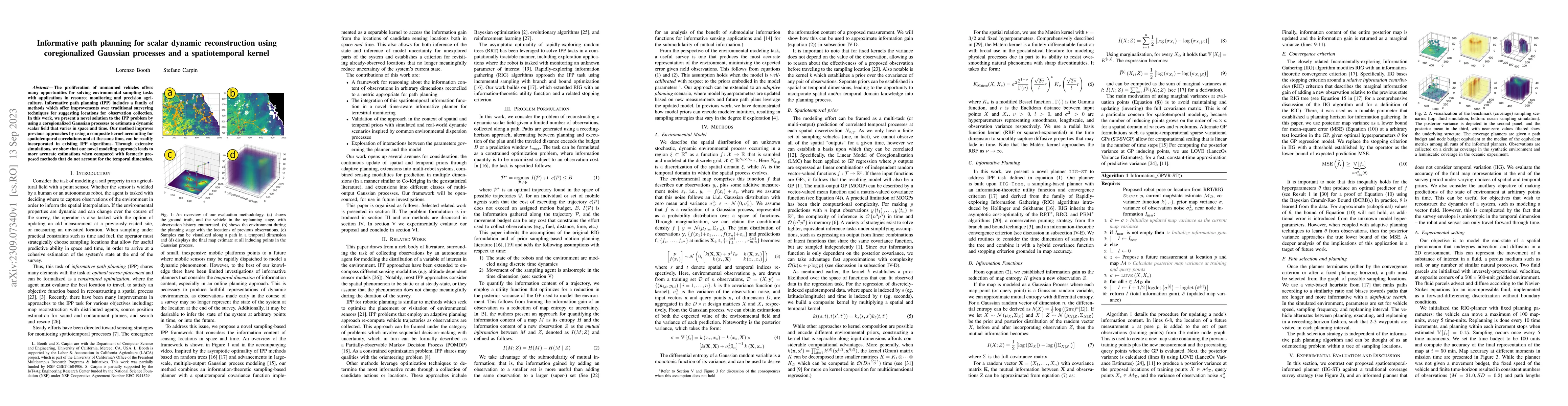
The proliferation of unmanned vehicles offers many opportunities for solving environmental sampling tasks with applications in resource monitoring and precision agriculture. Informative path planning (IPP) includes a family of methods which offer improvements over traditional surveying techniques for suggesting locations for observation collection. In this work, we present a novel solution to the IPP problem by using a coregionalized Gaussian processes to estimate a dynamic scalar field that varies in space and time. Our method improves previous approaches by using a composite kernel accounting for spatiotemporal correlations and at the same time, can be readily incorporated in existing IPP algorithms. Through extensive simulations, we show that our novel modeling approach leads to more accurate estimations when compared with formerly proposed methods that do not account for the temporal dimension.
AI Key Findings
Generated Sep 07, 2025
Methodology — What approach did the authors take?
The research employed a spatiotemporal Gaussian process to model environmental data and develop an informed path planning strategy.
Key Results — What are the main findings?
- Improved map accuracy compared to naive and conventional approaches
- Reduced posterior variance through adaptive sampling
- Effective use of spatiotemporal priors for improved performance
Significance — Why does this research matter?
This work contributes to the development of more accurate and efficient environmental monitoring systems, enabling better decision-making in resource management.
Technical Contribution — What is the technical contribution?
The development of a spatiotemporal Gaussian process-based informed path planning strategy, enabling adaptive sampling and reduced posterior variance.
Novelty — What is new about this work?
This work introduces the use of spatiotemporal priors in path planning, offering improved performance and accuracy compared to existing approaches.
Limitations — What are the limitations of this study?
- Dependence on high-quality prior knowledge
- Computational complexity may limit scalability
Future Work — What did the authors propose for future work?
- Investigating time-varying kernels for improved performance
- Exploring multi-robot systems and sensor fusion techniques
- Developing more efficient algorithms for large-scale applications
Paper Details
How to Cite This Paper
@article{booth2023informative,
title = {Informative path planning for scalar dynamic reconstruction using
coregionalized Gaussian processes and a spatiotemporal kernel},
author = {Booth, Lorenzo and Carpin, Stefano},
year = {2023},
eprint = {2309.07340},
archivePrefix = {arXiv},
primaryClass = {cs.RO},
}
Booth, L., & Carpin, S. (2023). Informative path planning for scalar dynamic reconstruction using
coregionalized Gaussian processes and a spatiotemporal kernel. arXiv. https://arxiv.org/abs/2309.07340
Booth, Lorenzo, and Stefano Carpin. "Informative path planning for scalar dynamic reconstruction using
coregionalized Gaussian processes and a spatiotemporal kernel." arXiv, 2023, arxiv.org/abs/2309.07340.
PDF Preview
Key Terms
Citation Network
Current paper (gray), citations (green), references (blue)
Display is limited for performance on very large graphs.
Similar Papers
Found 4 papersInformative Path Planning to Explore and Map Unknown Planetary Surfaces with Gaussian Processes
Ashten Akemoto, Frances Zhu
Multi-Robot Informative Path Planning from Regression with Sparse Gaussian Processes (with Appendix)
Kalvik Jakkala, Srinivas Akella
| Title | Authors | Year | Actions |
|---|
Comments (0)