Integrating Research Data Management into Geographical Information Systems
Publication
Metrics
AI Quick Summary
A new tool integrates research data management into geospatial mesh generation, enabling easy sharing of ocean modeling data and promoting reproducibility in simulations.
Paper Preview
Abstract
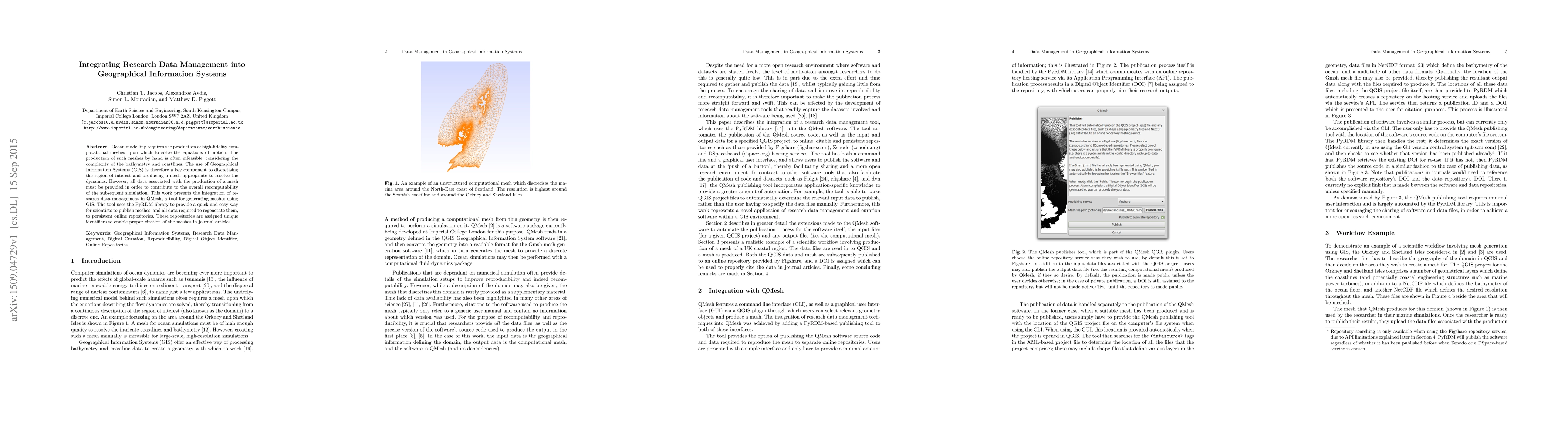
Ocean modelling requires the production of high-fidelity computational meshes upon which to solve the equations of motion. The production of such meshes by hand is often infeasible, considering the complexity of the bathymetry and coastlines. The use of Geographical Information Systems (GIS) is therefore a key component to discretising the region of interest and producing a mesh appropriate to resolve the dynamics. However, all data associated with the production of a mesh must be provided in order to contribute to the overall recomputability of the subsequent simulation. This work presents the integration of research data management in QMesh, a tool for generating meshes using GIS. The tool uses the PyRDM library to provide a quick and easy way for scientists to publish meshes, and all data required to regenerate them, to persistent online repositories. These repositories are assigned unique identifiers to enable proper citation of the meshes in journal articles.
AI Key Findings
Get AI-generated insights about this paper's methodology, results, significance, and more — seven facets brought into focus.
Impact
Paper Details
PDF Preview
Key Terms
Citation Network
Current paper (gray), citations (green), references (blue)
Display is limited for performance on very large graphs.
Discussion 0