Publication
Metrics
AI Quick Summary
This paper explores the use of satellite images from Google Earth and other platforms to illustrate physics concepts, focusing on surface and internal sea waves, and the Karman vortices in the atmosphere, aiming to engage students in engineering schools with wave phenomena.
Paper Preview
Abstract
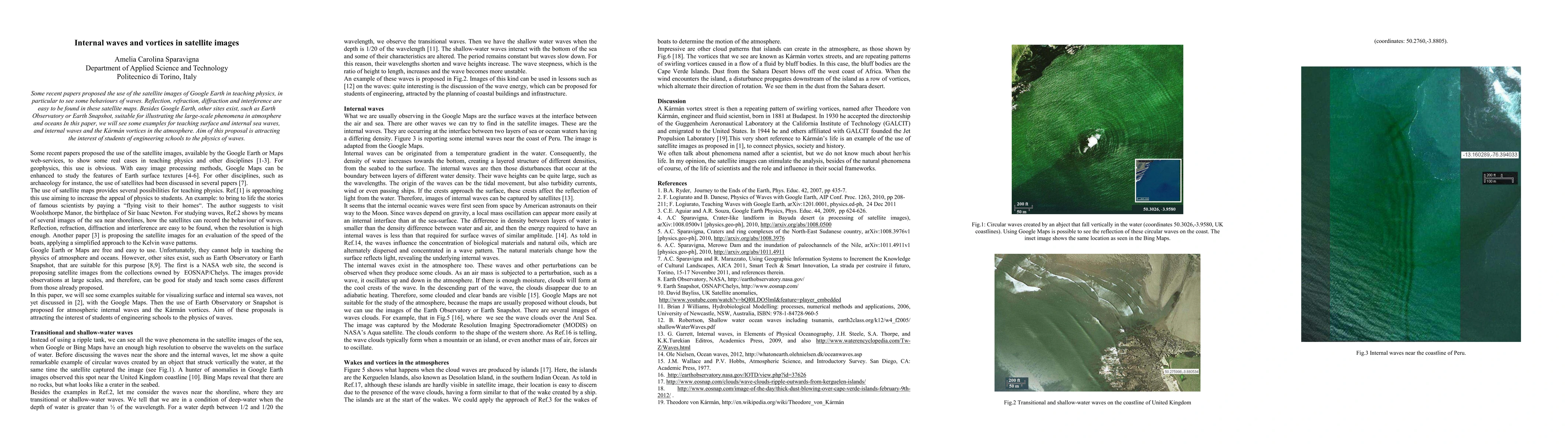
Some recent papers proposed the use of the satellite images of Google Earth in teaching physics, in particular to see some behaviours of waves. Reflection, refraction, diffraction and interference are easy to be found in these satellite maps. Besides Google Earth, other sites exist, such as Earth Observatory or Earth Snapshot, suitable for illustrating the large-scale phenomena in atmosphere and oceans In this paper, we will see some examples for teaching surface and internal sea waves, and internal waves and the K\'arm\'an vortices in the atmosphere. Aim of this proposal is attracting the interest of students of engineering schools to the physics of waves.
AI Key Findings
Get AI-generated insights about this paper's methodology, results, significance, and more — seven facets brought into focus.
Impact
Paper Details
PDF Preview
Key Terms
Citation Network
Current paper (gray), citations (green), references (blue)
Display is limited for performance on very large graphs.
Discussion 0