Joint multi-modal Self-Supervised pre-training in Remote Sensing: Application to Methane Source Classification
Publication
Metrics
AI Quick Summary
This paper explores self-supervised pre-training methods using joint multi-modal remote sensing data to reduce the need for labeled data. It evaluates the effectiveness of these methods for methane source classification, leveraging geographical position and multiple sensor views.
Paper Preview
Abstract
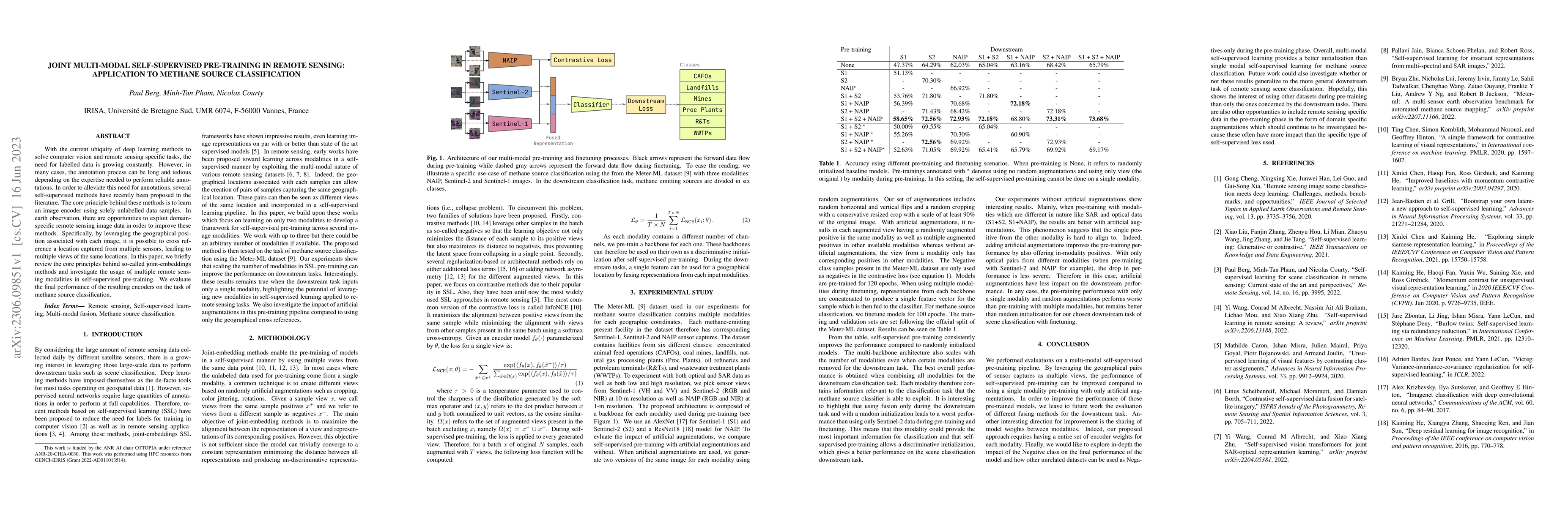
With the current ubiquity of deep learning methods to solve computer vision and remote sensing specific tasks, the need for labelled data is growing constantly. However, in many cases, the annotation process can be long and tedious depending on the expertise needed to perform reliable annotations. In order to alleviate this need for annotations, several self-supervised methods have recently been proposed in the literature. The core principle behind these methods is to learn an image encoder using solely unlabelled data samples. In earth observation, there are opportunities to exploit domain-specific remote sensing image data in order to improve these methods. Specifically, by leveraging the geographical position associated with each image, it is possible to cross reference a location captured from multiple sensors, leading to multiple views of the same locations. In this paper, we briefly review the core principles behind so-called joint-embeddings methods and investigate the usage of multiple remote sensing modalities in self-supervised pre-training. We evaluate the final performance of the resulting encoders on the task of methane source classification.
AI Key Findings
Get AI-generated insights about this paper's methodology, results, significance, and more — seven facets brought into focus.
Impact
Paper Details
Authors
PDF Preview
Key Terms
Citation Network
Current paper (gray), citations (green), references (blue)
Display is limited for performance on very large graphs.
Discussion 0