This paper presents a novel computational approach for evaluating urban
metrics through density gradient analysis using multi-modal satellite imagery,
with applications including public transport and other urban systems. By
combining optical and Synthetic Aperture Radar (SAR) data, we develop a method
to segment urban areas, identify urban centers, and quantify density gradients.
Our approach calculates two key metrics: the density gradient coefficient
($\alpha$) and the minimum effective distance (LD) at which density reaches a
target threshold. We further employ machine learning techniques, specifically
K-means clustering, to objectively identify uniform and high-variability
regions within density gradient plots. We demonstrate that these metrics
provide an effective screening tool for public transport analyses by revealing
the underlying urban structure. Through comparative analysis of two
representative cities with contrasting urban morphologies (monocentric vs
polycentric), we establish relationships between density gradient
characteristics and public transport network topologies. Cities with clear
density peaks in their gradient plots indicate distinct urban centers requiring
different transport strategies than those with more uniform density
distributions. This methodology offers urban planners a cost-effective,
globally applicable approach to preliminary public transport assessment using
freely available satellite data. The complete implementation, with additional
examples and documentation, is available in an open-source repository under the
MIT license at https://github.com/nexri/Satellite-Imagery-Urban-Analysis.
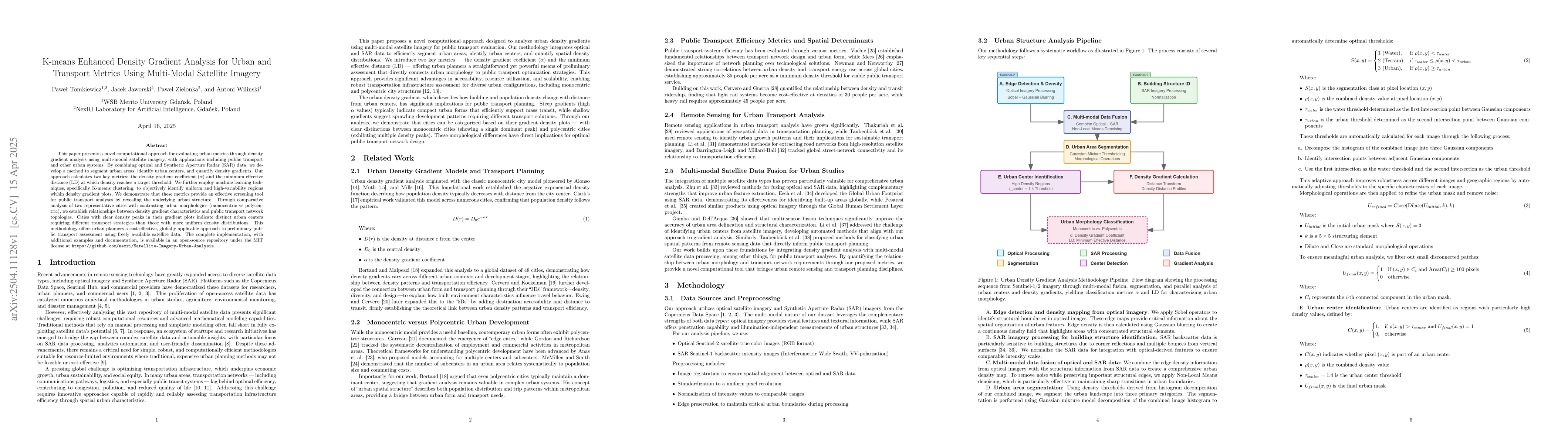
Discussion 0