This paper presents a change detection method that identifies land cover
changes from aerial imagery, using semantic segmentation, a machine learning
approach. We present a land cover classification training pipeline with Deeplab
v3+, state-of-the-art semantic segmentation technology, including data
preparation, model training for seven land cover types, and model exporting
modules. In the land cover change detection system, the inputs are images
retrieved from Google Earth at the same location but from different times. The
system then predicts semantic segmentation results on these images using the
trained model and calculates the land cover class percentage for each input
image. We see an improvement in the accuracy of the land cover semantic
segmentation model, with a mean IoU of 0.756 compared to 0.433, as reported in
the DeepGlobe land cover classification challenge. The land cover change
detection system that leverages the state-of-the-art semantic segmentation
technology is proposed and can be used for deforestation analysis, land
management, and urban planning.
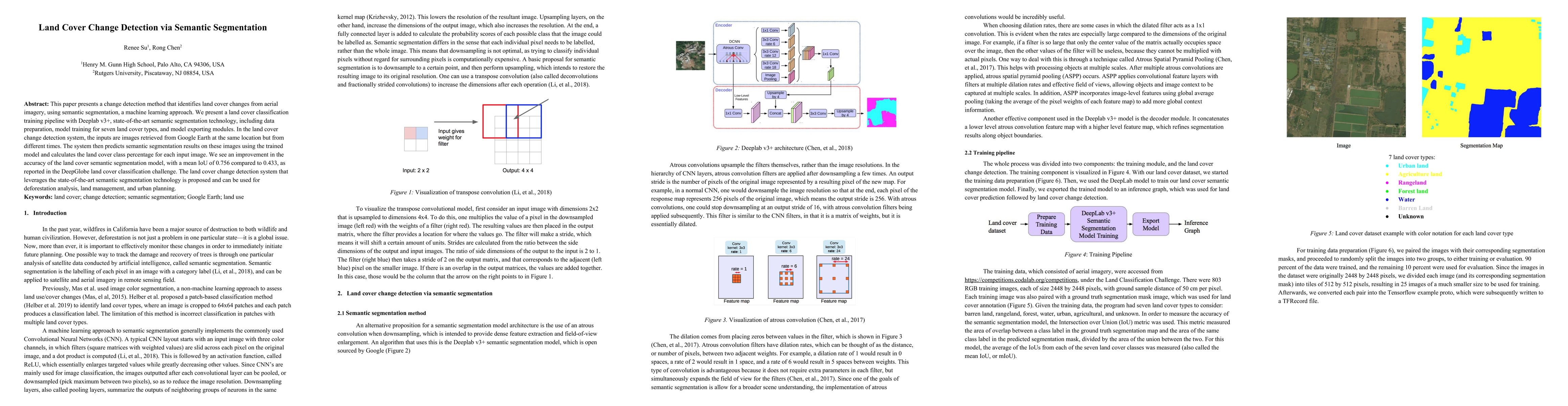
Discussion 0