Publication
Metrics
AI Quick Summary
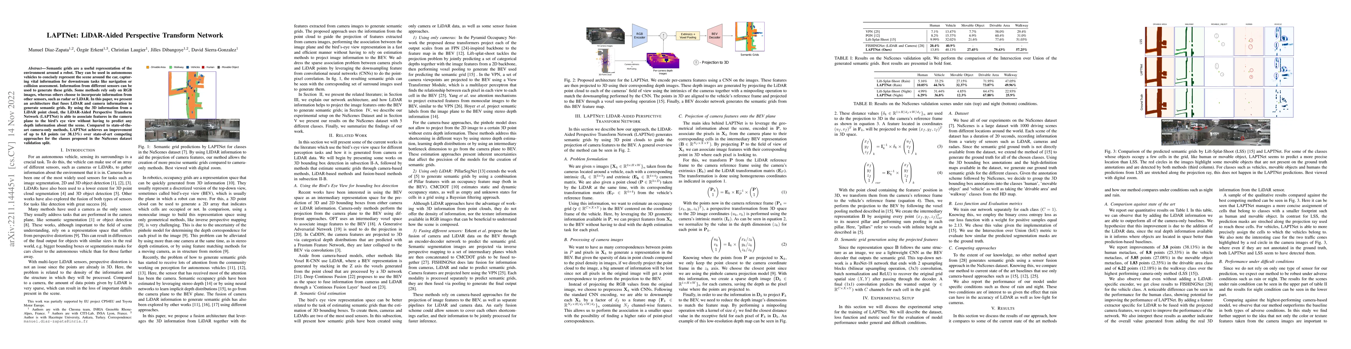
LAPTNet fuses LiDAR and camera data to generate semantic grids, enhancing feature association from camera to bird's eye view without depth prediction, achieving a 38.13% improvement over camera-only methods in the Nuscenes dataset.
Paper Preview
Abstract
Semantic grids are a useful representation of the environment around a robot. They can be used in autonomous vehicles to concisely represent the scene around the car, capturing vital information for downstream tasks like navigation or collision assessment. Information from different sensors can be used to generate these grids. Some methods rely only on RGB images, whereas others choose to incorporate information from other sensors, such as radar or LiDAR. In this paper, we present an architecture that fuses LiDAR and camera information to generate semantic grids. By using the 3D information from a LiDAR point cloud, the LiDAR-Aided Perspective Transform Network (LAPTNet) is able to associate features in the camera plane to the bird's eye view without having to predict any depth information about the scene. Compared to state-of-theart camera-only methods, LAPTNet achieves an improvement of up to 8.8 points (or 38.13%) over state-of-art competing approaches for the classes proposed in the NuScenes dataset validation split.
AI Key Findings
Get AI-generated insights about this paper's methodology, results, significance, and more — seven facets brought into focus.
Impact
Paper Details
Authors
PDF Preview
Key Terms
Citation Network
Current paper (gray), citations (green), references (blue)
Display is limited for performance on very large graphs.
Discussion 0