Learning and Aggregating Lane Graphs for Urban Automated Driving
Publication
Metrics
AI Quick Summary
This paper proposes a novel bottom-up approach for estimating lane graphs from aerial imagery, addressing challenges in complex lane topologies and occlusions. The method aggregates overlapping lane graphs into a consistent global graph, demonstrating high accuracy and consistency even in occluded areas.
Paper Preview
Abstract
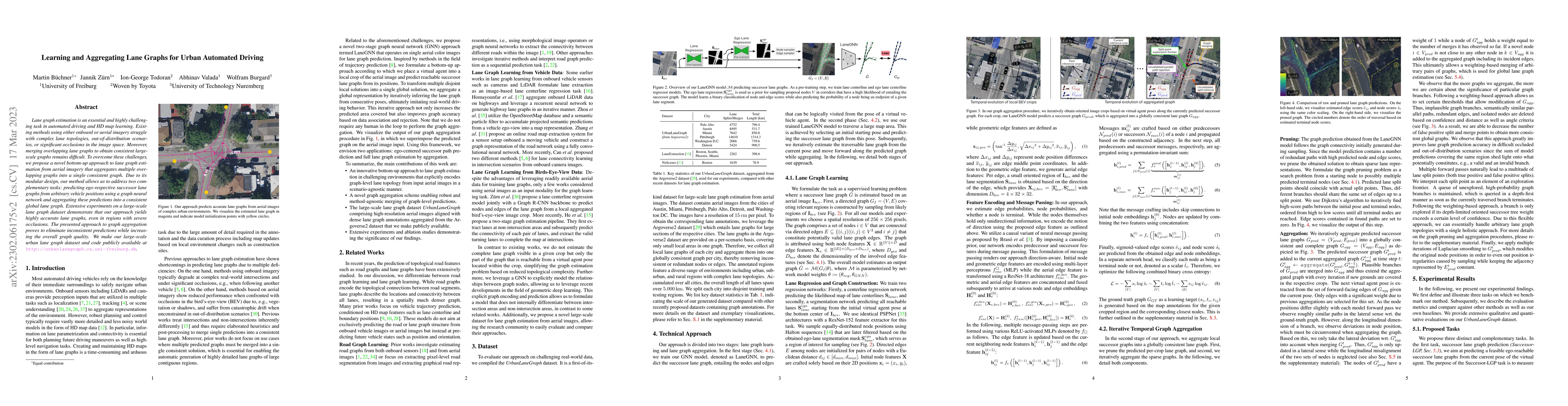
Lane graph estimation is an essential and highly challenging task in automated driving and HD map learning. Existing methods using either onboard or aerial imagery struggle with complex lane topologies, out-of-distribution scenarios, or significant occlusions in the image space. Moreover, merging overlapping lane graphs to obtain consistent large-scale graphs remains difficult. To overcome these challenges, we propose a novel bottom-up approach to lane graph estimation from aerial imagery that aggregates multiple overlapping graphs into a single consistent graph. Due to its modular design, our method allows us to address two complementary tasks: predicting ego-respective successor lane graphs from arbitrary vehicle positions using a graph neural network and aggregating these predictions into a consistent global lane graph. Extensive experiments on a large-scale lane graph dataset demonstrate that our approach yields highly accurate lane graphs, even in regions with severe occlusions. The presented approach to graph aggregation proves to eliminate inconsistent predictions while increasing the overall graph quality. We make our large-scale urban lane graph dataset and code publicly available at http://urbanlanegraph.cs.uni-freiburg.de.
AI Key Findings
Get AI-generated insights about this paper's methodology, results, significance, and more — seven facets brought into focus.
Impact
Paper Details
Authors
PDF Preview
Key Terms
Citation Network
Current paper (gray), citations (green), references (blue)
Display is limited for performance on very large graphs.
Discussion 0