Publication
Metrics
AI Quick Summary
This research paper proposes integrating remote sensing vision data into road network data to improve performance on machine learning applications. It achieves state-of-the-art results on a road type classification task using a segmentation of road edges based on spatio-temporal characteristics.
Paper Preview
Abstract
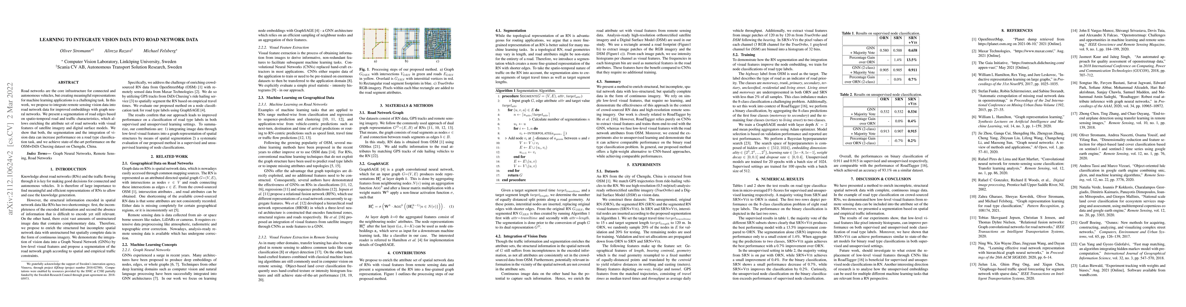
Road networks are the core infrastructure for connected and autonomous vehicles, but creating meaningful representations for machine learning applications is a challenging task. In this work, we propose to integrate remote sensing vision data into road network data for improved embeddings with graph neural networks. We present a segmentation of road edges based on spatio-temporal road and traffic characteristics, which allows to enrich the attribute set of road networks with visual features of satellite imagery and digital surface models. We show that both, the segmentation and the integration of vision data can increase performance on a road type classification task, and we achieve state-of-the-art performance on the OSM+DiDi Chuxing dataset on Chengdu, China.
AI Key Findings
Get AI-generated insights about this paper's methodology, results, significance, and more — seven facets brought into focus.
Impact
Paper Details
Authors
PDF Preview
Key Terms
Citation Network
Current paper (gray), citations (green), references (blue)
Display is limited for performance on very large graphs.
Discussion 0