Leveraging Multi-Temporal Sentinel 1 and 2 Satellite Data for Leaf Area Index Estimation With Deep Learning
Publication
Metrics
AI Quick Summary
This paper introduces a deep learning method using multi-temporal Sentinel 1 and 2 satellite data for pixel-wise Leaf Area Index (LAI) prediction, achieving 0.06 RMSE and 0.93 R2 score. It employs a multi-U-net architecture pre-trained separately for different data modalities and fine-tuned for seasonality.
Paper Preview
Abstract
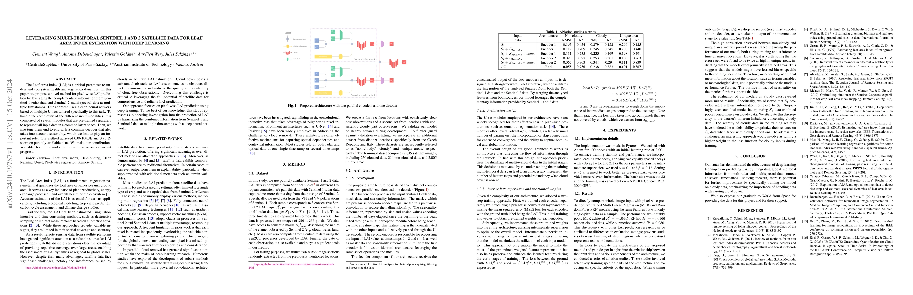
The Leaf Area Index (LAI) is a critical parameter to understand ecosystem health and vegetation dynamics. In this paper, we propose a novel method for pixel-wise LAI prediction by leveraging the complementary information from Sentinel 1 radar data and Sentinel 2 multi-spectral data at multiple timestamps. Our approach uses a deep neural network based on multiple U-nets tailored specifically to this task. To handle the complexity of the different input modalities, it is comprised of several modules that are pre-trained separately to represent all input data in a common latent space. Then, we fine-tune them end-to-end with a common decoder that also takes into account seasonality, which we find to play an important role. Our method achieved 0.06 RMSE and 0.93 R2 score on publicly available data. We make our contributions available at https://github.com/valentingol/LeafNothingBehind for future works to further improve on our current progress.
AI Key Findings
Get AI-generated insights about this paper's methodology, results, significance, and more — seven facets brought into focus.
Impact
Authors
PDF Preview
Citation Network
Current paper (gray), citations (green), references (blue)
Display is limited for performance on very large graphs.
Discussion 0