Leveraging Vision Reconstruction Pipelines for Satellite Imagery
Publication
Metrics
AI Quick Summary
This paper investigates the application of state-of-the-art computer vision reconstruction pipelines to satellite imagery, addressing challenges in adapting these methods for remote sensing. The study demonstrates that vision-based reconstruction techniques can achieve competitive speed and accuracy in satellite imagery analysis.
Paper Preview
Abstract
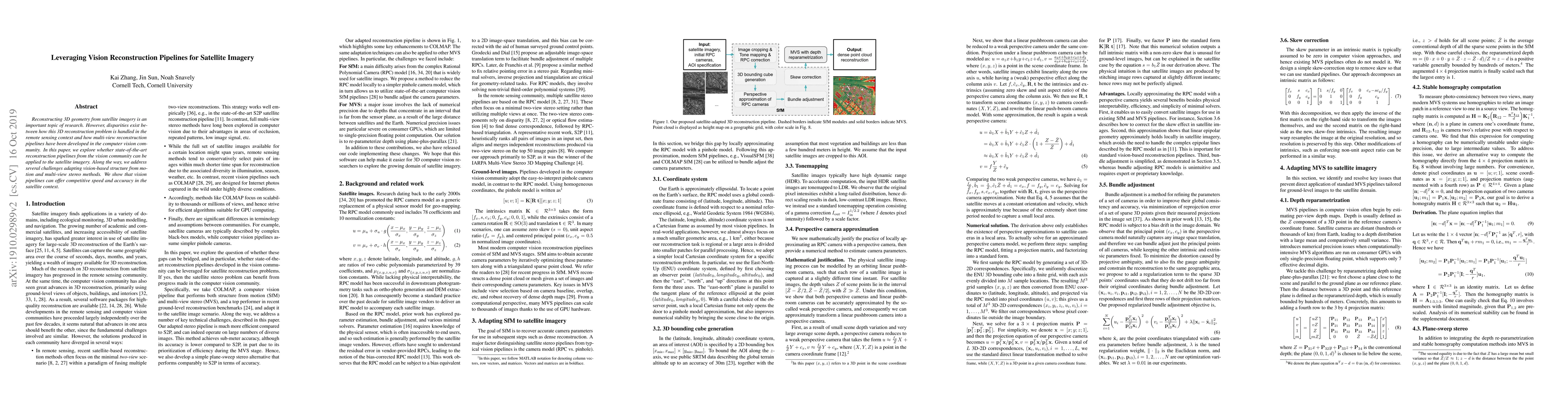
Reconstructing 3D geometry from satellite imagery is an important topic of research. However, disparities exist between how this 3D reconstruction problem is handled in the remote sensing context and how multi-view reconstruction pipelines have been developed in the computer vision community. In this paper, we explore whether state-of-the-art reconstruction pipelines from the vision community can be applied to the satellite imagery. Along the way, we address several challenges adapting vision-based structure from motion and multi-view stereo methods. We show that vision pipelines can offer competitive speed and accuracy in the satellite context.
AI Key Findings
Get AI-generated insights about this paper's methodology, results, significance, and more — seven facets brought into focus.
Impact
Paper Details
Authors
PDF Preview
Key Terms
Citation Network
Current paper (gray), citations (green), references (blue)
Display is limited for performance on very large graphs.
Discussion 0