Lidar-based exploration and discretization for mobile robot planning
Publication
Metrics
AI Quick Summary
Researchers propose a method to bridge low-level control and high-level planning for robots using lidar data, enabling collision-free trajectories while reducing computational complexity.
Paper Preview
Abstract
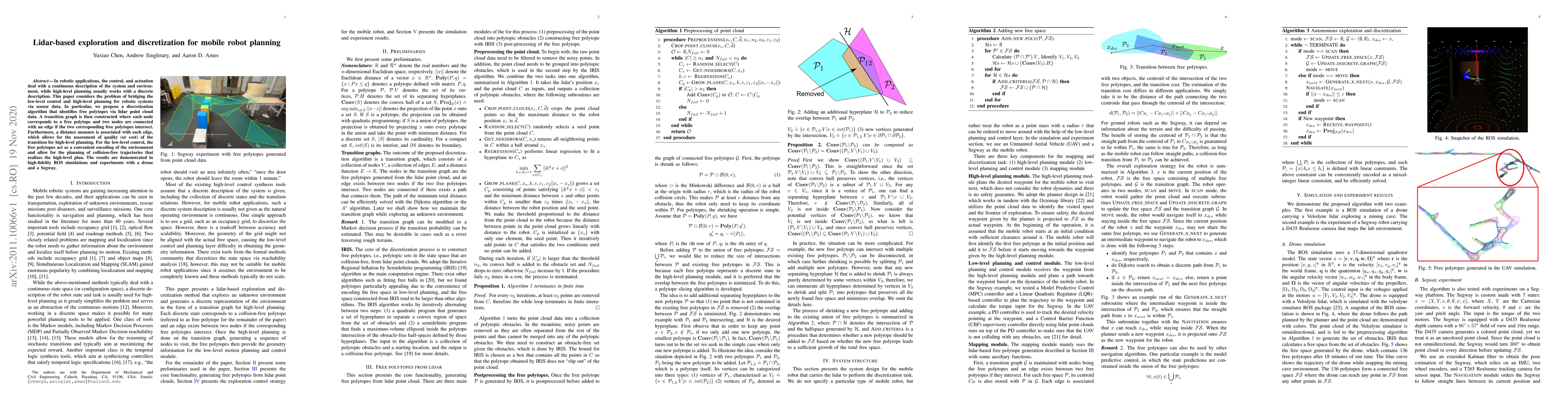
In robotic applications, the control, and actuation deal with a continuous description of the system and environment, while high-level planning usually works with a discrete description. This paper considers the problem of bridging the low-level control and high-level planning for robotic systems via sensor data. In particular, we propose a discretization algorithm that identifies free polytopes via lidar point cloud data. A transition graph is then constructed where each node corresponds to a free polytope and two nodes are connected with an edge if the two corresponding free polytopes intersect. Furthermore, a distance measure is associated with each edge, which allows for the assessment of quality (or cost) of the transition for high-level planning. For the low-level control, the free polytopes act as a convenient encoding of the environment and allow for the planning of collision-free trajectories that realizes the high-level plan. The results are demonstrated in high-fidelity ROS simulations and experiments with a drone and a Segway.
AI Key Findings
Get AI-generated insights about this paper's methodology, results, significance, and more — seven facets brought into focus.
Impact
Paper Details
Authors
PDF Preview
Key Terms
Citation Network
Current paper (gray), citations (green), references (blue)
Display is limited for performance on very large graphs.
Discussion 0